A look back at July's numbers
By: Alex Countee
Posted: Aug 1, 2017 6:06 AM EDT

-
1:52

While the rain is over, the cooling temperatures are not
-
2:28

Public forum hosted by John Glenn High School students
-
3:34

Kickoff preview with ABC57’s Allison Hayes
-
0:57

Completion of Martin Luther King Jr. Dream Center one step closer
-
0:36

Niles High School students network with local professionals
-
3:59

Political group asks Indiana Democrats to vote in Republican...
-
3:01

New Buffalo Area Schools to build workforce housing
-
2:37

City seeks feedback for final Potawatomi Park plan
-
7:27

Center for the Homeless hosting Dancing With Our Stars
-
2:10

More wet weather arriving later tonight, but sunnier skies after
-
3:16

Public input on the proposal to restart the Palisades Nuclear...
-
1:35

Dari Fair opened Wednesday for 2024 season, temperatures cool...

As we start a new month, it's a good time to take a look back at the month of July. For our high temperatures, we saw a pretty even split between above and below average days, as several rounds of high pressure kept us warm for a few days, with cold fronts and showers and storms knocking us back down. The most interesting result from the past month was our total rainfall amounts.
July started off on the wet side for some of us in Michiana. Areas along and south of Highway 30 saw many days of heavy rainfall producing flash flooding and ponding on roadways. Plymouth, Bourbon, Leesburg
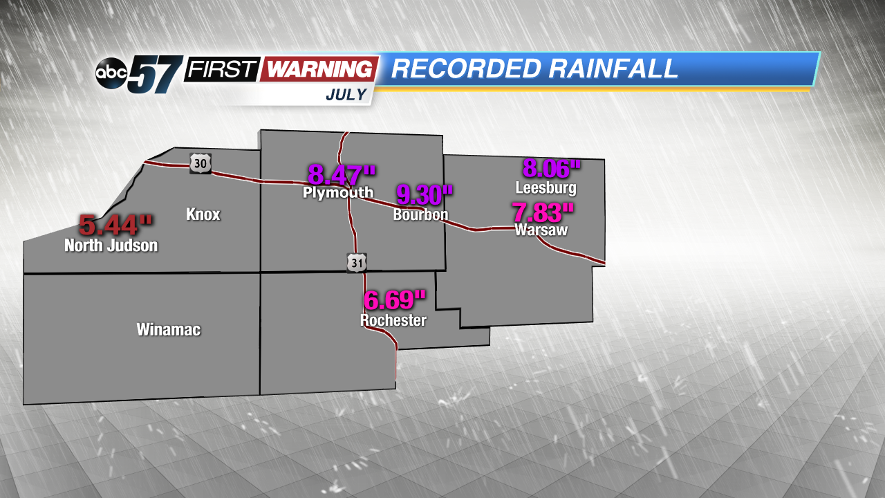 Flooding rains early in the month helped produced these high totals.
Moving into August, our temperatures are expected to trend on the warmer side, meaning that we could see the mid to upper 80s return before summer's end.
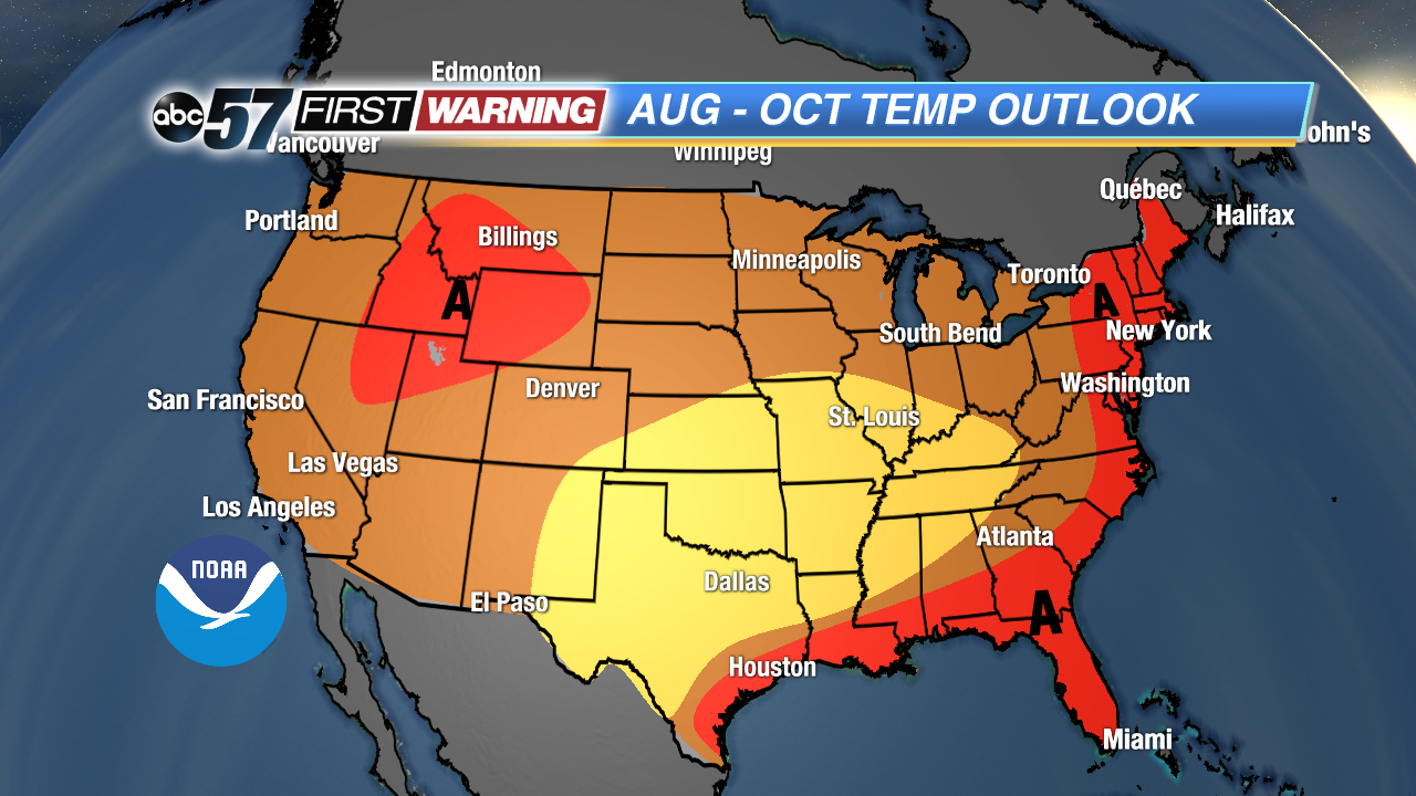 In August, we have a 40-50% chance of seeing warmer-than-normal highs.
Sign up for the ABC 57Newsletter