Another round of storms tonight, more flooding possible.


Update 11:30 PM: Storm threat ending overnight, storm activity stayed south of the area. Very muggy Tuesday and Wednesday before more storms.
Update 7:30 PM: Even with a Severe Thunderstorm Watch issued for the southern half of the area, widespread severe weather seems unlikely. Heavy downpours and localized flooding remains the main threat.
A Flash Flood Watch has been issued for the entire area until 2 AM Monday. Thunderstorms this evening could produce heavy rain and possibly more severe weather.
A very muggy midweek, highs warm well into the 80s and the humidity will stay steamy with dewpoints in the 70s. The excessive moisture in the atmosphere will keep the threat of heavy rain and flooding in the forecast through Wednesday. The next round of storms are expected Tuesday night through Wednesday. The end of the week will be milder and drier.
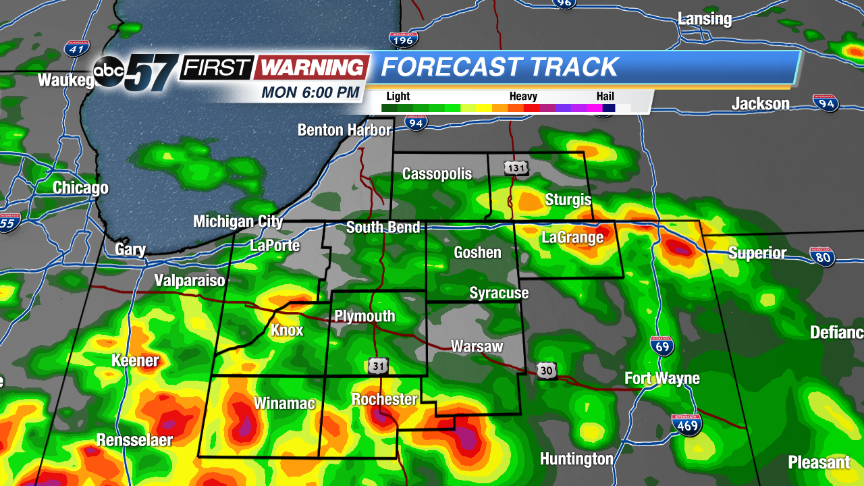 Hi-Res model of Forecast Track plots more heavy rain through the evening. mostly south of US-30.
Tonight: Evening showers and storms, low 68.
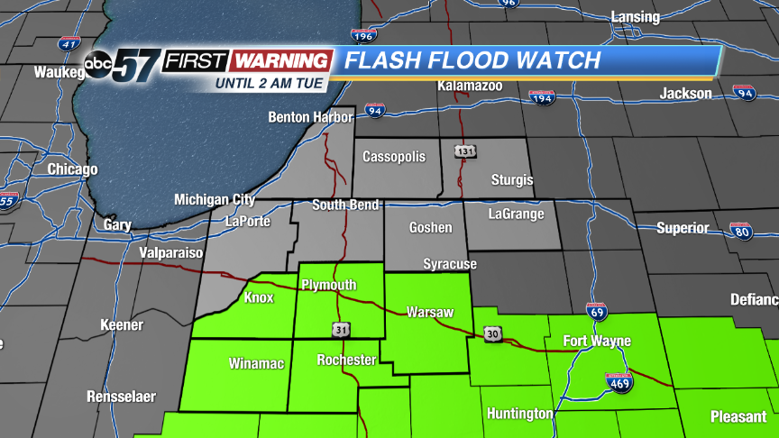 Flash Flood Watch issued until 2 AM for area along / south of US-30. These areas already heavy flooding and standing water.
Tuesday: Partly cloudy, high 86, chance of storms late.
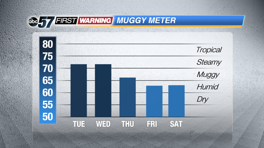 The Muggy Meter stays high through Wednesday before we get some relief.
Wednesday: Shower and storms likely, high of 88.
Thursday: Partly cloudy, highs in the low 80s.