
-
0:54

Goodwill ’Little Black Dress’ event raises funds for community...
-
1:45

Cheers Bar and Grill liquor license renewed following controversy
-
2:40

Kyle Rudolph weighs in on fellow Irish, Joe Alt, ahead of NFL...
-
0:58

Contractors prepare bids for multi-million-dollar Four Winds...
-
3:11

Caleb Williams and Marvin Harrison Jr. weigh in on upcoming draft
-
3:18

New settlement with Indiana allows Landmark to apply for recertification
-
2:32

NFL Analysts break down Joe Alt’s stock
-
1:21

Fair Thursday wet / windy weekend
-
2:52

Union Township sues UNAS over ambulance stripped for parts
-
1:32

Bridging the healthcare gap in Michiana
-
1:44

Drier but cooler weather returns for Wednesday
-
2:32

County Council asks questions on 900-acre Granger rezoning and...

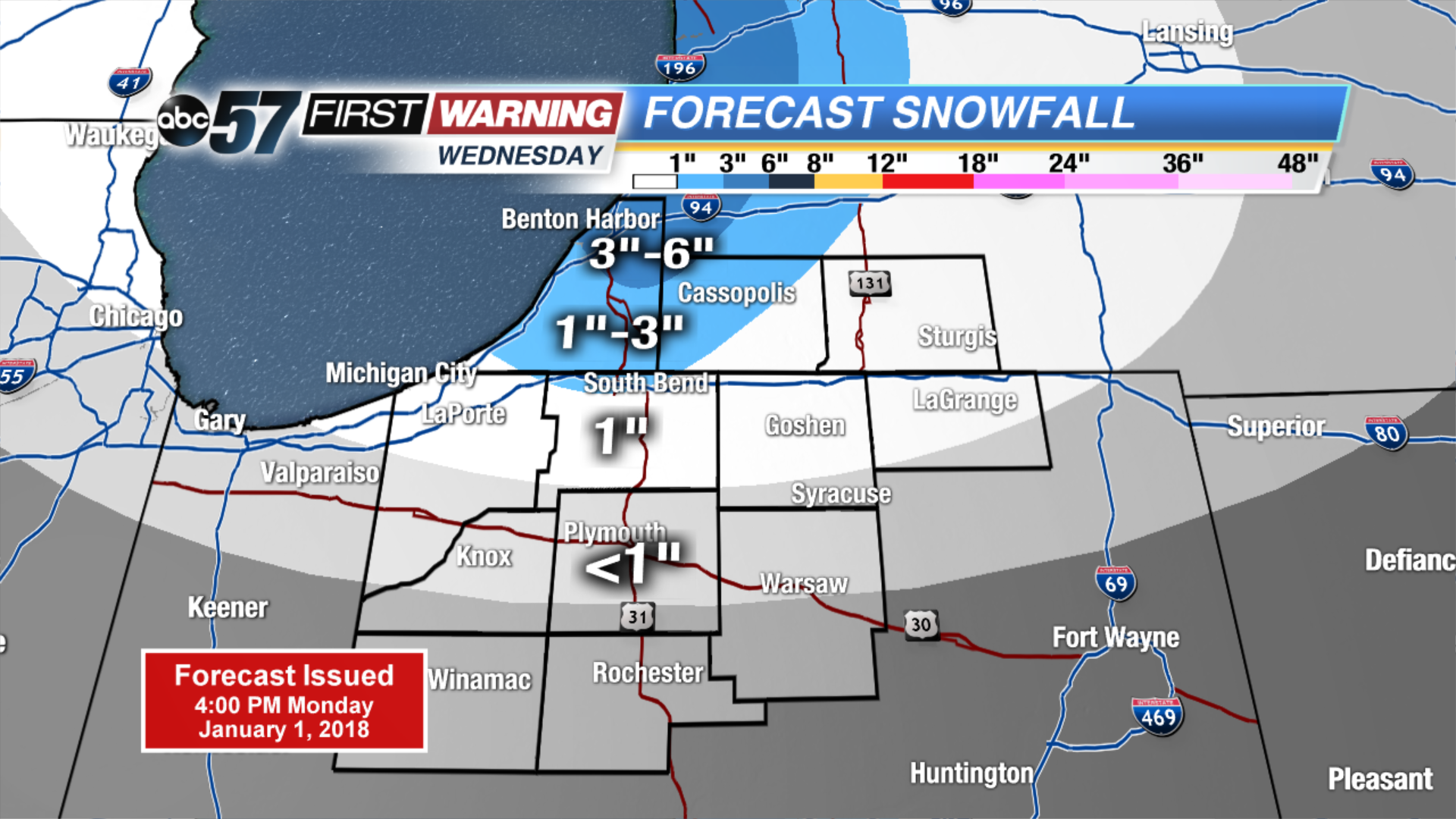
Tuesday may be the coldest day so far in the Frigid holiday season, temps start well below zero and highs will not break into the double digits. The wind chill will also be a factor staying mostly subzero. There is a short break from snow with mostly sunny skies. The next round of snow will be Wednesday – Thursday with another clipper, plus lake effect. Amounts will not be extreme but some areas could see another three to six by Friday morning.
Tonight: Partly to mostly clear, low of -8.
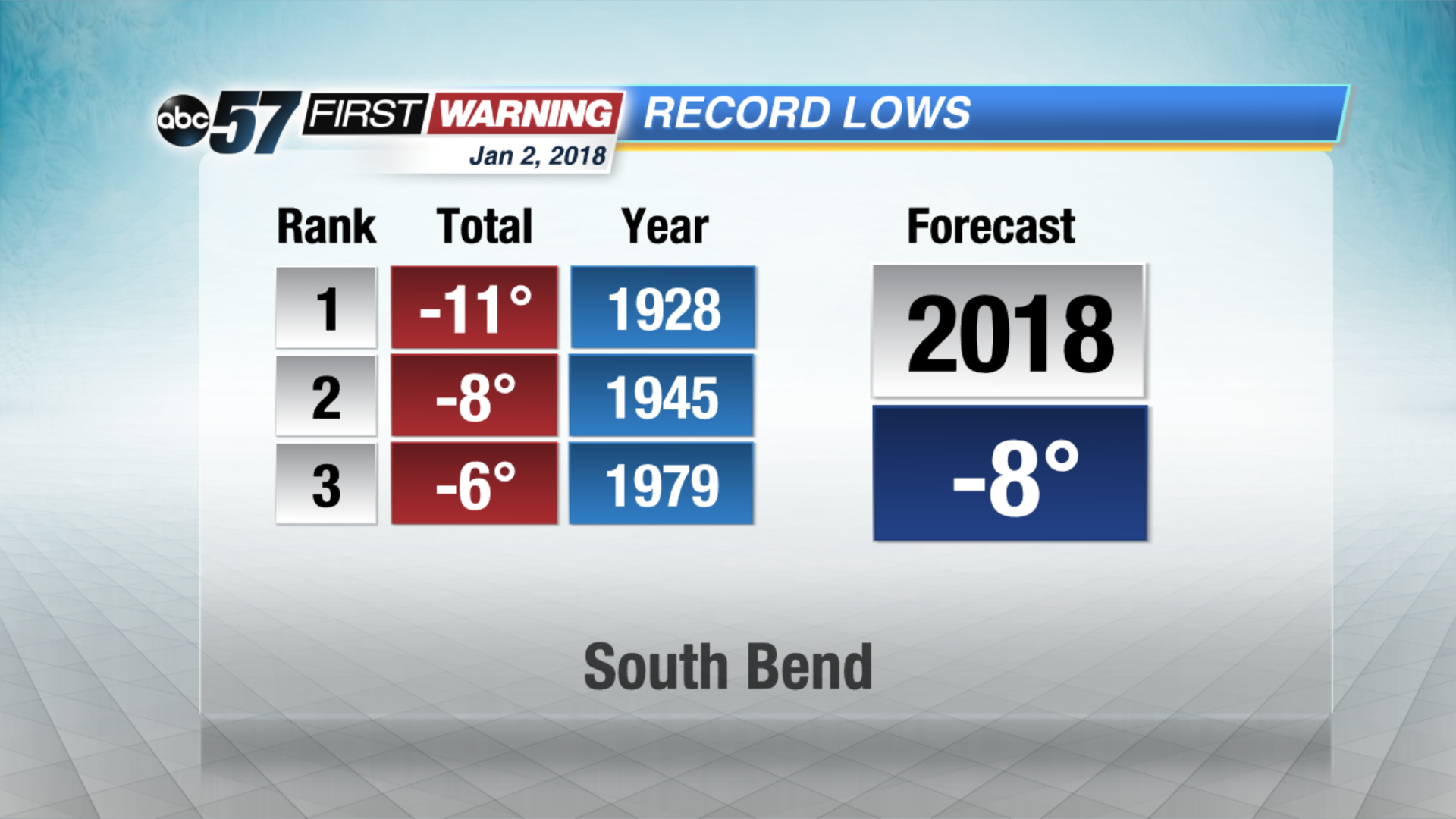 Forecast nearing record lows Tuesday morning
Tuesday: Mostly sunny. Highs near 6.
Wednesday: Mostly cloudy, afternoon and evening snow showers, high of 14.
Thursday: Lake effect snow showers, highs in the lower teens.
Sign up for the ABC 57Newsletter