Confidence growing for impactful winter storm Saturday

-
1:58

Rain returns tonight, storm chances picking up into tomorrow
-
2:20

Indiana Fever select Caitlin Clark #1 overall in WNBA Draft
-
5:31

Interview with Rep. Bill Huizenga over Israel-Iran conflict
-
1:05

Students perform in first-time joint concert event
-
2:31

Neighbors react after man barricaded himself in crashed vehicle
-
1:52

St. Joseph River at near-flood stage in Niles
-
1:03

Construction set to start on intersection at State Road 933 and...
-
1:54

Event honoring Vietnam War veterans to be held in New Carlisle
-
2:44

St. Joe marinas await completion of Bicentennial Bridge construction
-
2:05

The storm threat is shifting to Wednesday
-
1:24

WNBA Draft looking to impact the next generation of female athletes
-
2:31

One last quiet, pleasant day before storms return tomorrow

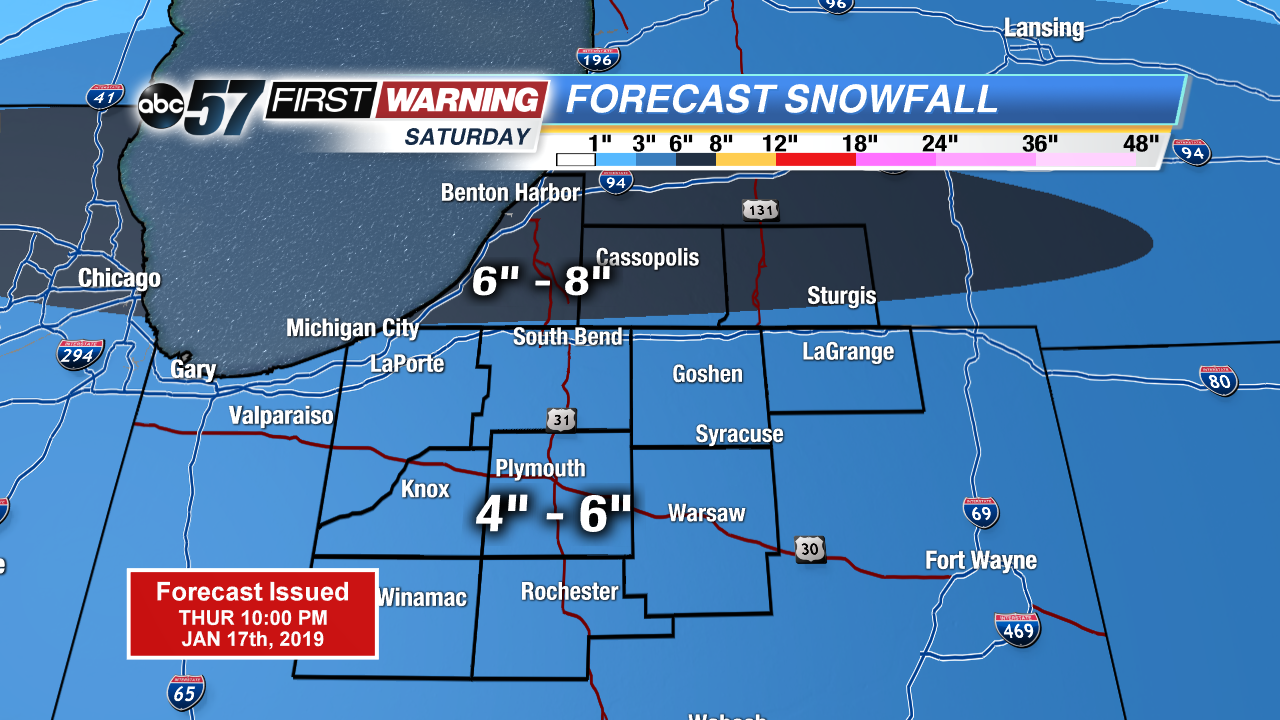
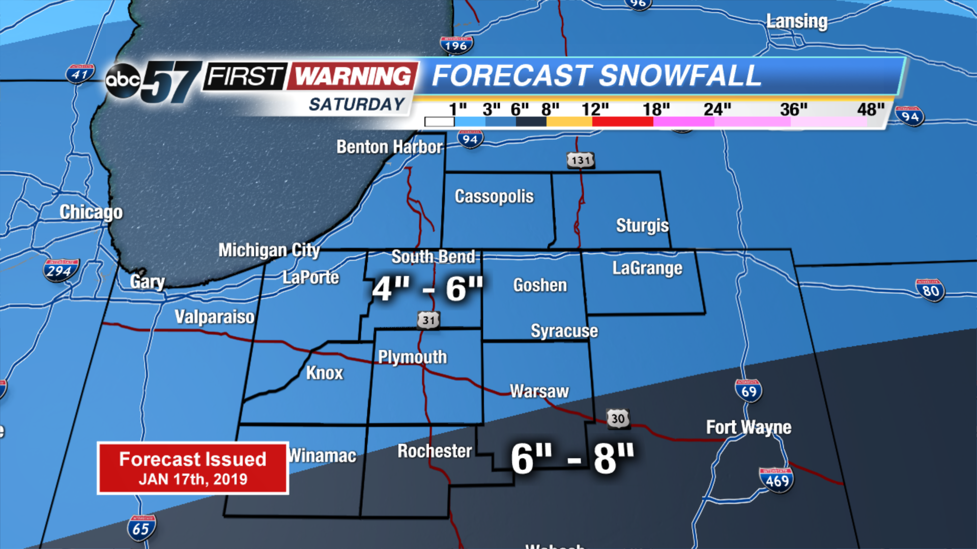
UPDATED Snow Forecast: Latest round of models has moved the more prolonged and heaviest snow band north. In general the forecast remains unchanged, with a 4"-6" range but the highest potential of 6"-8" has moved north.
Freezing drizzle / fog possible Thursday evening, areas of black ice possible through Friday morning.
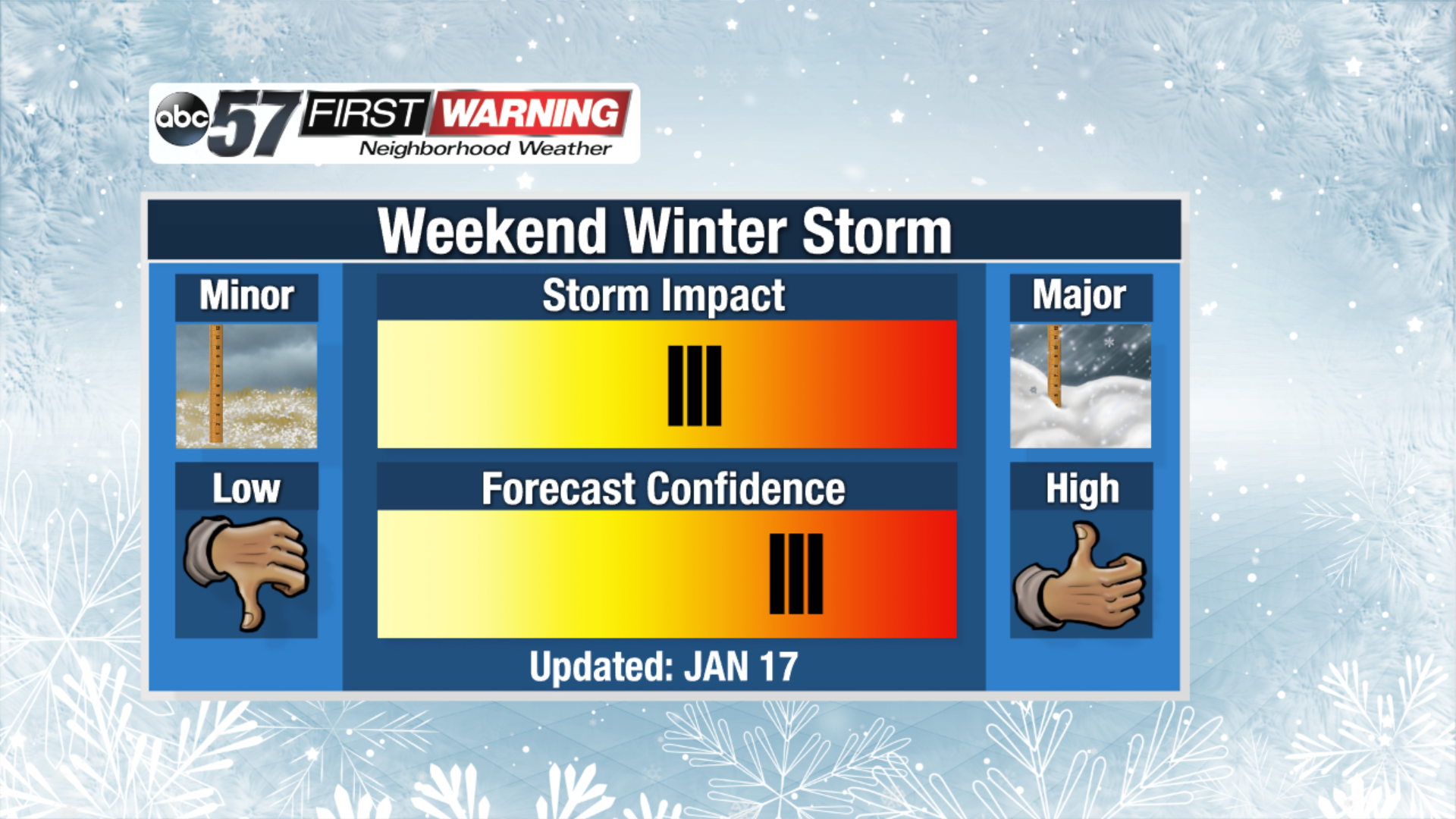
Confidence continues to grow for impactful winter weather this weekend. Friday is the lull before the storm, with snow showers starting as early as Friday evening and lasting through Saturday afternoon. The peak of the snow is 2:00 AM to 2:00 PM Saturday, at least four inches of snow is likely, with areas of more than six possible. The bitter cold arrives Sunday with frigid lows below zero early Monday.
Tonight: Freezing fog / drizzle , low of 26.
Friday: Cloudy, high of 32.
Saturday: Snowy, heavy at times and windy, high of 24.
Sunday: Partly cloudy, very cold, high of 16.