First the cold, then a chance of snow
Posted: Dec 5, 2017 4:19 PM EDT

-
2:11

Students gearing up for local careers in Manufacturing
-
2:13

Sunny today, but expect a wetter and warmer weekend
-
0:54

Goodwill ’Little Black Dress’ event raises funds for community...
-
1:45

Cheers Bar and Grill liquor license renewed following controversy
-
2:40

Kyle Rudolph weighs in on fellow Irish, Joe Alt, ahead of NFL...
-
0:58

Contractors prepare bids for multi-million-dollar Four Winds...
-
3:11

Caleb Williams and Marvin Harrison Jr. weigh in on upcoming draft
-
3:18

New settlement with Indiana allows Landmark to apply for recertification
-
2:32

NFL Analysts break down Joe Alt’s stock
-
1:21

Fair Thursday wet / windy weekend
-
2:52

Union Township sues UNAS over ambulance stripped for parts
-
1:32

Bridging the healthcare gap in Michiana

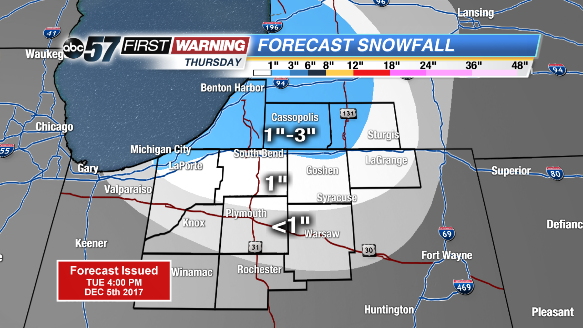
Winter is here to stay as the forecast stays near or below freezing for the next two weeks. Wednesday will still be breezy but the wind does gradually calm into the evening. Lake effect snow is likely to start Wednesday night and last through Thursday. Lake effect zones will see measurable snowfall of one inch or more, some could see up to three inches. The next focus for widespread snow will be Saturday.
Tonight: Partly cloudy, breezy, low 24.
![]()
Wednesday: Mostly cloudy, breezy, chance of lake effect snow, high of 34.
Thursday: Lake effect snow showers, high of 28.
Friday: Partly cloudy, highs in the upper 20s.
Sign up for the ABC 57Newsletter