Foggy start to Tuesday, active weather week

-
1:32

Bridging the healthcare gap in Michiana
-
1:44

Drier but cooler weather returns for Wednesday
-
2:32

County Council asks questions on 900-acre Granger rezoning and...
-
0:56

Notre Dame women’s basketball team holds end-of-season awards...
-
0:45

Idea Week kicks off with networking at launch party
-
2:59

SBPD officer takes in six puppies while SBARC remains on Parvo...
-
1:45

How rain is hampering planting progress
-
2:43

From classrooms to rental units in Chikaming Township
-
1:47

Cooler and drier midweek, milder and wetter weekend
-
2:36

Aspiring chefs are cultivating their dreams at Ivy Tech
-
1:40

Rainy and breezy Tuesday
-
0:58

Hockey team hosts ’Rally for Rudy’ car wash

Gloomy, with fog developing overnight, low visibility and temperatures near freezing, slick spots are possible on bridges and overpasses.
This week will be active but milder with highs closer to 50 most of this week. Tuesday is sunny, Wednesday is rainy and Thursday is sunny once again. The main focus will be on a power storm system this coming weekend. Strong wind may be the greatest threat, this is separate from any shower/storms that could produce higher gusts. Colder air return Sunday with a chance of snow.
Tonight: Mostly to partly cloudy, morning fog, low 32. 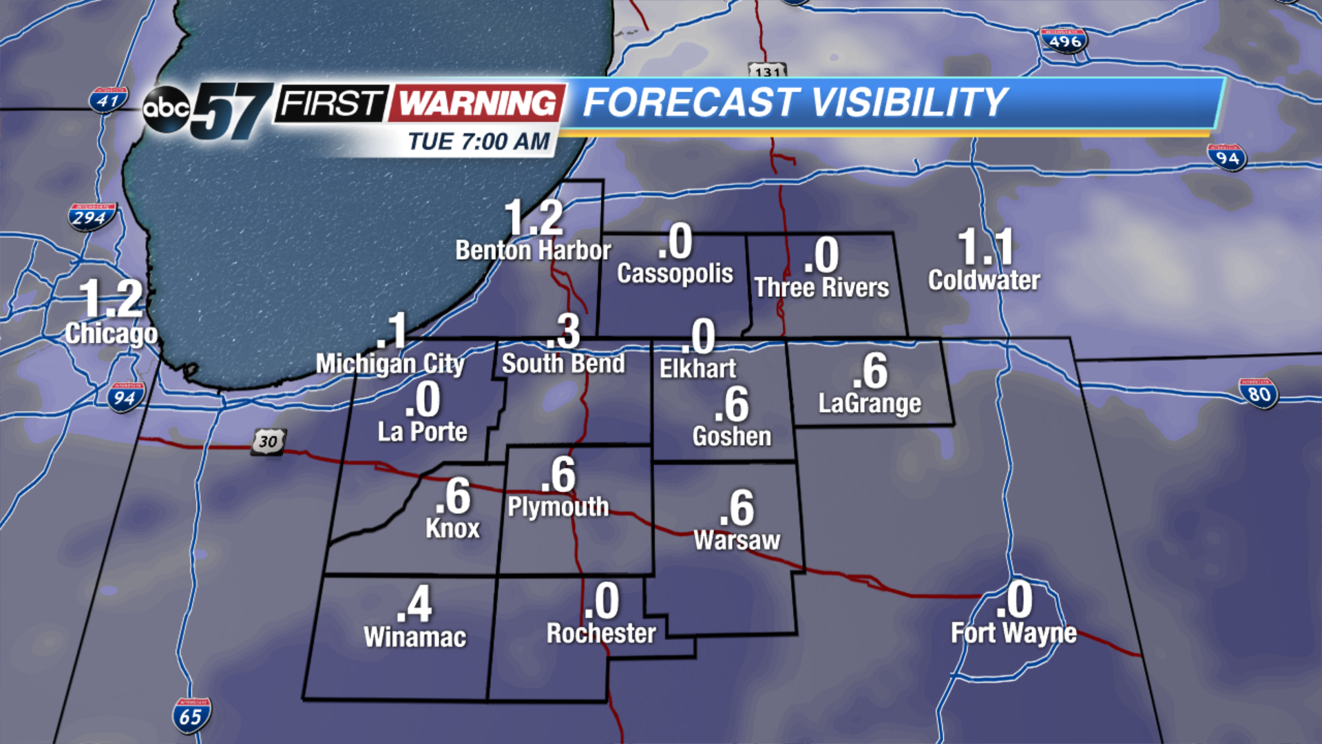 Forecast visibility Tuesday morning. The more clouds break, the more likely there could be dense fog.
Tuesday: Mostly sunny, high of 48.
Wednesday: Rain likely, high of 50.
Thursday: Mostly sunny, highs in the mid-40s. 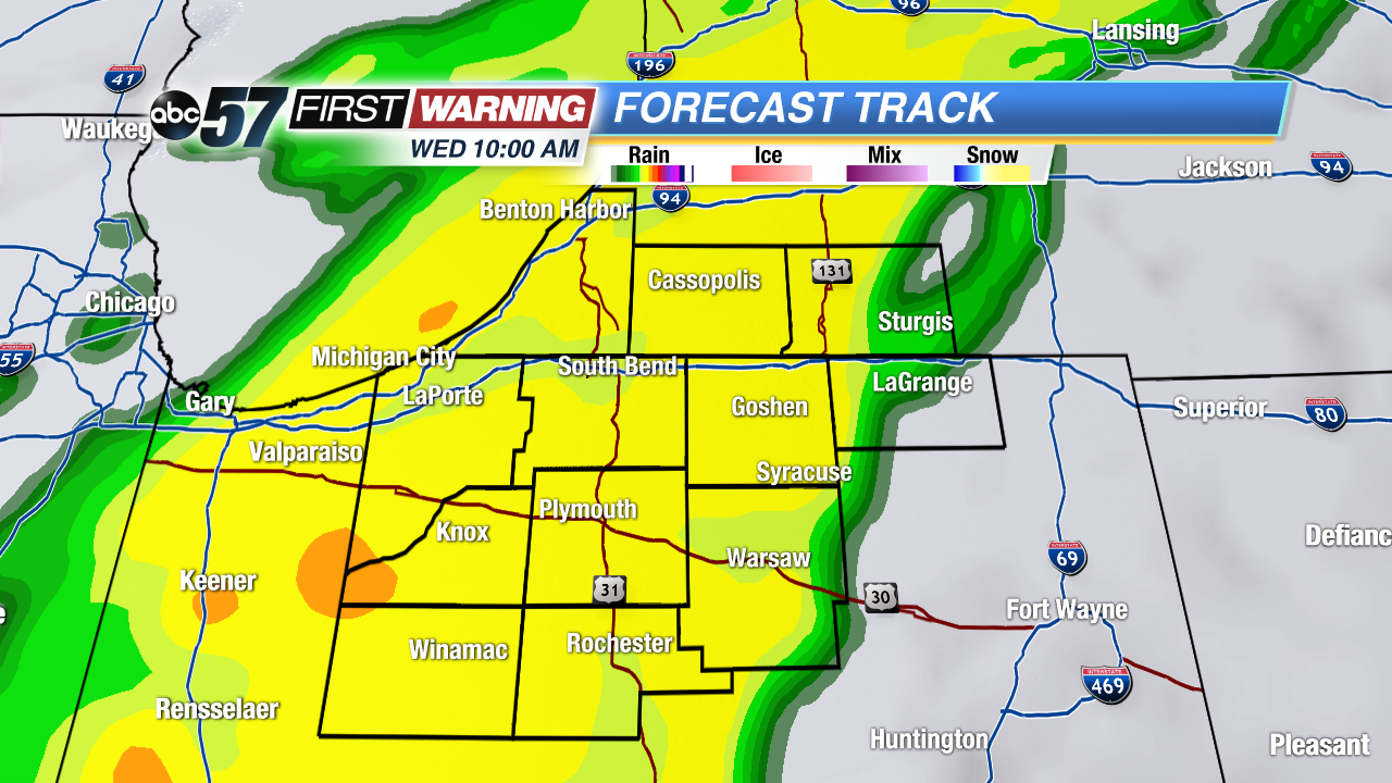 Swath of rain Wednesday could be moderate to heavy.