
-
2:24

Suspect arrested for allegedly sexually assaulting two girls...
-
0:25

Humane Society of St. Joseph County holds microchip clinic
-
2:58

Pulaski County Community Foundation provides support for childcare...
-
3:14

Green wave of economic growth in Michigan from marijuana dispensaries
-
1:28

Brisk, breezy but beautiful weekend
-
0:48

University Park Mall holding parking-lot carnival this week
-
1:52

While the rain is over, the cooling temperatures are not
-
2:28

Public forum hosted by John Glenn High School students
-
3:34

Kickoff preview with ABC57’s Allison Hayes
-
0:57

Completion of Martin Luther King Jr. Dream Center one step closer
-
0:36

Niles High School students network with local professionals
-
3:59

Political group asks Indiana Democrats to vote in Republican...

Steady snow continues through Friday evening. Final totals of a foot or more are still likely for extreme Northern Indiana and Southwest Michigan. As temperatures drop, snow packed roads will stay slick into Saturday morning.
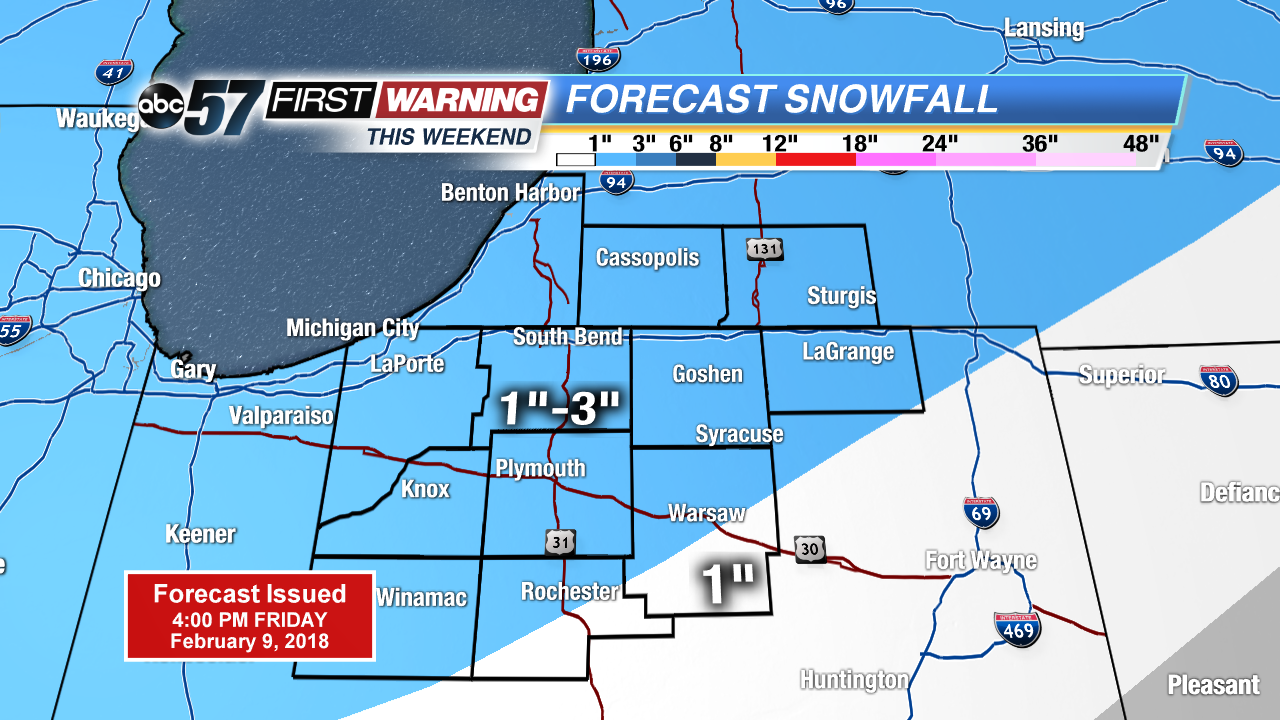
The snowy pattern continues this weekend but total accumulation of one to three inches Saturday and Sunday is nothing compared to Friday’s snowfall. Temperatures remain cold with highs in the mid-20s and lows in the teens. Sunshine returns to start next week, with highs warming above freezing.
Today: Heavy snow, highs near 30.
Tonight: Scattered snow showers, low of 18.
Saturday: Scattered snow showers, high of 27.
Sunday: AM snow showers, highs in the middle 20s.
Sign up for the ABC 57Newsletter