
-
3:14

Green wave of economic growth in Michigan from marijuana dispensaries
-
1:28

Brisk, breezy but beautiful weekend
-
1:52

While the rain is over, the cooling temperatures are not
-
2:28

Public forum hosted by John Glenn High School students
-
3:34

Kickoff preview with ABC57’s Allison Hayes
-
0:57

Completion of Martin Luther King Jr. Dream Center one step closer
-
0:36

Niles High School students network with local professionals
-
3:59

Political group asks Indiana Democrats to vote in Republican...
-
3:01

New Buffalo Area Schools to build workforce housing
-
2:37

City seeks feedback for final Potawatomi Park plan
-
7:27

Center for the Homeless hosting Dancing With Our Stars
-
2:10

More wet weather arriving later tonight, but sunnier skies after

A frigid start to Thursday, temperatures near zero, this is the calm before our next snow storm. The next round of snow will be the biggest this week and has the potential to be one of the biggest single day events of the season. Friday, a nearly all-day snow is expected with accumulation of more than six inches likely. The pattern stays snowy this weekend but looks to break next week.
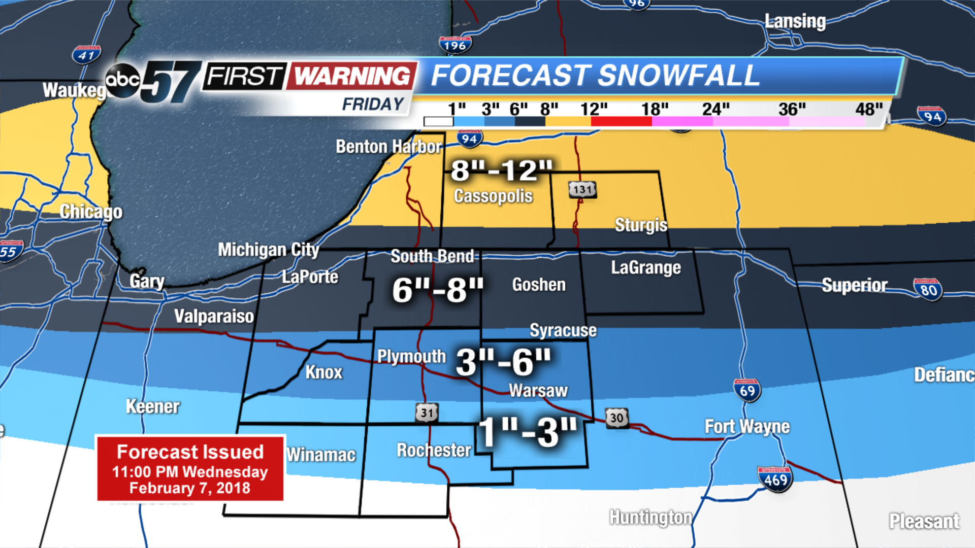
Tonight: Flurries ending, partly cloudy, low of 2.
Thursday: Mostly cloudy, chance of snow, high of 18.
Friday: Heavy snow, high of 28.
Saturday: PM Snow showers, highs in the mid-20s.
Sign up for the ABC 57Newsletter