High humidity and more storms Wednesday

-
2:59

SBPD officer takes in six puppies while SBARC remains on Parvo...
-
1:45

How rain is hampering planting progress
-
2:43

From classrooms to rental units in Chikaming Township
-
1:47

Cooler and drier midweek, milder and wetter weekend
-
2:36

Aspiring chefs are cultivating their dreams at Ivy Tech
-
1:40

Rainy and breezy Tuesday
-
0:58

Hockey team hosts ’Rally for Rudy’ car wash
-
1:06

South Bend School Board of Trustees reviewing the code of conduct
-
2:33

Newly annexed land in Mishawaka could see a Gurley Leep auto...
-
3:48

Farmers react to recent trend of farmland sales in St. Joseph...
-
2:47

Reaction to potential TikTok ban
-
2:49

Michigan City Fire Department holds ’Firefighter for a Day’...

Update: Storms likely overnight along and north of the Toll Rd. Heavy rain the biggest threat.
Extremely humid overnight, this could fuel a few evening showers but the focus will be on storms, starting Wednesday morning. Storms could be strong to severe Wednesday.
 Wednesday storm threat lasts all day for round 1 and round 2.
Wednesday will likely start and end with storms, a one-two punch that will likely bring heavy rain and possible flooding and severe weather. The high humidity is the fuel for storms, after round one Wednesday morning, temperatures warm into the low 90s, the heat index will be closer to 95. Round two of storms is likely Wednesday night, once again heavy rain, flooding and severe weather is possible. Depending on how things play out, Wednesday night’s storms could be bigger threat. The humidity drops and milder weather returns for the weekend.
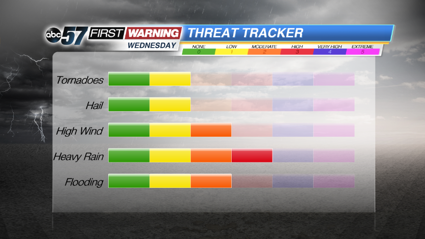 Heavy rain and flooding look to be the most likely and widespread threat for most.
Tonight: Humid, spotty evening showers, scattered AM storms, low 70.
Wednesday: AM scattered storms, hot and humid, high 90, another round of storms late.
Thursday: AM Showers, mostly cloudy, high 84.
Friday: Mostly sunny, highs near 80.
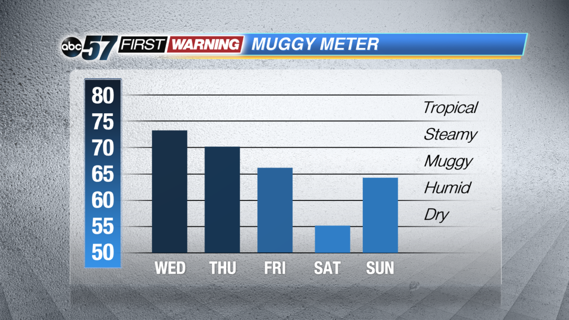 The humidity won't break until late Thursday, early Friday.