
-
2:32

County Council asks questions on 900-acre Granger rezoning and...
-
0:56

Notre Dame women’s basketball team holds end-of-season awards...
-
0:45

Idea Week kicks off with networking at launch party
-
2:59

SBPD officer takes in six puppies while SBARC remains on Parvo...
-
1:45

How rain is hampering planting progress
-
2:43

From classrooms to rental units in Chikaming Township
-
1:47

Cooler and drier midweek, milder and wetter weekend
-
2:36

Aspiring chefs are cultivating their dreams at Ivy Tech
-
1:40

Rainy and breezy Tuesday
-
0:58

Hockey team hosts ’Rally for Rudy’ car wash
-
1:06

South Bend School Board of Trustees reviewing the code of conduct
-
2:33

Newly annexed land in Mishawaka could see a Gurley Leep auto...

The threat of rain overnight is minimal with only isolated pop-up showers.
No relief from the humidity Friday, hot and very humid with a head index 95 to 100. Friday night and early Saturday is the time frame for the next round of storms. The latest set models predict a one-two punch, Friday evening and again Saturday morning. Both could bring severe weather and combined the total rainfall could produce flooding with more the two inches possible. The steamy and stormy pattern end Sunday into Monday.
Tonight: Partly cloudy, extremely muggy, low 70
Friday: Very humid, high of 90, evening thunderstorms
Saturday: Morning thunderstorms, highs in the mid-80s.
 Heat index Friday forecast back between 95 and 100.
Sunday: Mostly sunny, high in the mid-80s.
 Round 1 of storms Friday evening
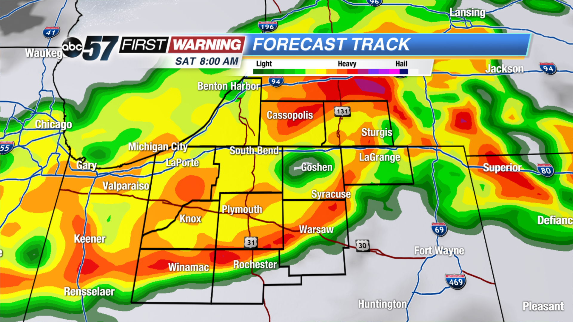 Round 2 of storms Saturday morning.
Sign up for the ABC 57Newsletter