We are no stranger to lake effect snow here in Northwest Indiana and Southwest Michigan. Just last year, many areas saw one their snowiest winters ever as over 80" of snow fell in parts of St. Joseph, La Porte and Berrien Counties. Those counties are in what is referred to as a "primary lake effect belt." In other words, being downwind of Lake Michigan puts those three counties in an ideal location to cash in on significant lake effect snow totals each winter. But does a warming climate have a say in lake effect potential?
Lake effect snow totals trending up overall since 1930Climate Central
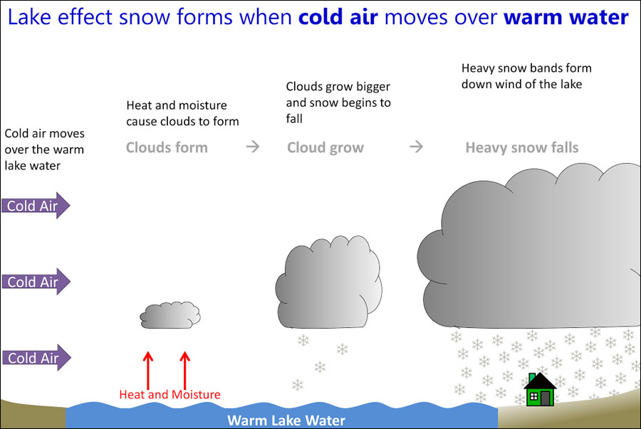
To get lake effect snow, you must have relatively warm lake water and a cold air mass moving over the lake. This interaction can lead to very impressive lake effect snow totals if the wind direction is just right. And, dating back to 1930, a study shows an increase in lake effect snowfall overall. Like most meteorological variables, there are ups and there are downs. Overall, though, the trend has been more lake effect snow each year for the last 87 years.
Current lake effect snow seasonClimate Central
This has been the case despite the atmosphere warming. However, the study suggests that the continued warming of our atmosphere will eventually lead to less in the way of extremely cold air masses moving over the Great Lakes. The result would be less lake effect snow and more lake effect rain for areas downwind of one of the five Great Lakes throughout the winter.
Lake effect snow season projected for 2050Climate Central
Not only that, but the length of the lake effect season is expected to shorten by the middle of this century. More precipitation will fall as rain or a mixture of rain and snow during the transitional months of October, November, April, and May. Many times the Great Lakes will see snow fly during these months. However, the likelihood of sufficiently cold air during these months will continue to decrease substantially by the latter half of the century, leading to less snow potential.
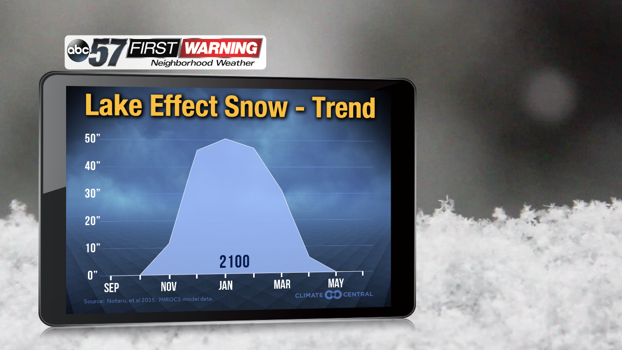
Lake effect snow season forecast for 2100Climate Central
It's not necessarily going to be a dramatic change in how long the lake effect snow season lasts by 2050. You may not even notice the difference unless you pay close attention each year. What is clear, though, according to the study and Climate Central, is the fact that the length of the lake effect snow season will shorten with warmer air becoming increasingly likely throughout the 21st century. Also of note is the heart of lake effect season is likely going to trend toward lasting from mid-December to early March. This is instead of the current peak, which is November thru late January. The reason why is simple: the lakes will not freeze over as often with warmer summers and falls. Without the freezing of the lakes, the lake effect snow machine is open for business. And, with less arctic air intrusions during November and early December, the chances of significant lake effect snow events drop. There will still be lake effect snow. There will still be extreme lake effect snow events. But they will tend to happen more often between Christmas and St. Patrick's Day as the atmosphere continues to warm.


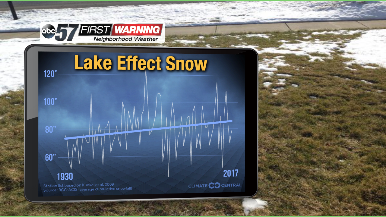 Lake effect snow totals trending up overall since 1930
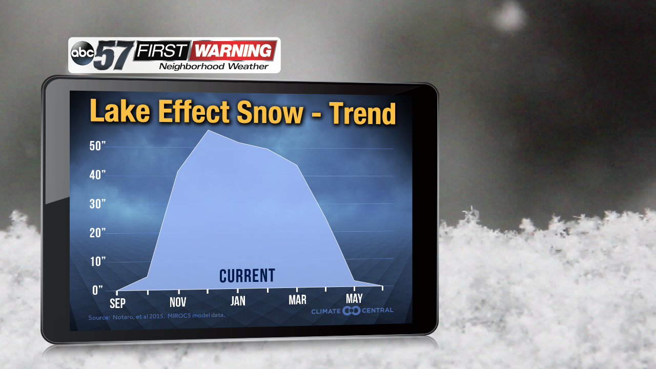 Current lake effect snow season
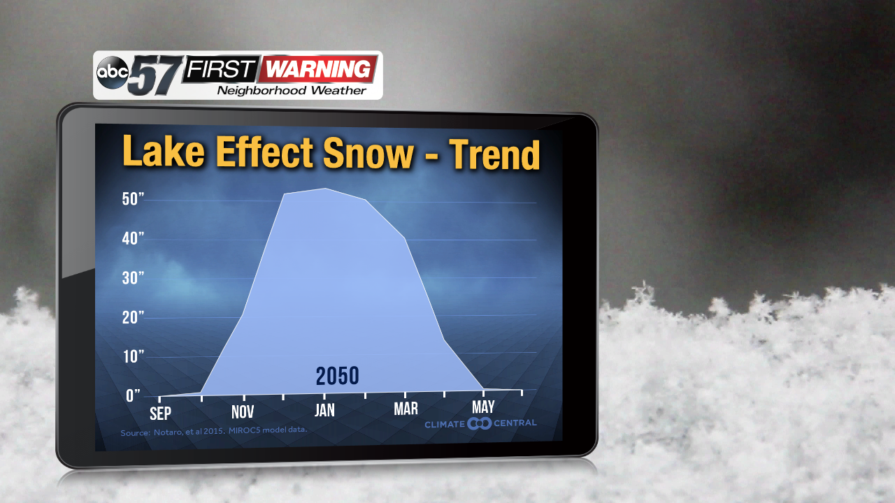 Lake effect snow season projected for 2050
 Lake effect snow season forecast for 2100