Local changes affecting Maria's path

-
0:25

Humane Society of St. Joseph County holds microchip clinic
-
2:58

Pulaski County Community Foundation provides support for childcare...
-
3:14

Green wave of economic growth in Michigan from marijuana dispensaries
-
1:28

Brisk, breezy but beautiful weekend
-
1:52

While the rain is over, the cooling temperatures are not
-
2:28

Public forum hosted by John Glenn High School students
-
3:34

Kickoff preview with ABC57’s Allison Hayes
-
0:57

Completion of Martin Luther King Jr. Dream Center one step closer
-
0:36

Niles High School students network with local professionals
-
3:59

Political group asks Indiana Democrats to vote in Republican...
-
3:01

New Buffalo Area Schools to build workforce housing
-
2:37

City seeks feedback for final Potawatomi Park plan

Summer temperatures won't be around Michiana for long! A cold front will push through the area on Wednesday, allowing our highs to fall dramatically into the low to mid 70s and into the upper 60s by the end of the week. But, this front that will move through will also have other impacts on the East Coast.
Hurricane Maria continues to spin off the East Coast as a weak Category 1 hurricane. It will continue to push to the north over the next few days, edging ever closer to the Outer Banks of North Carolina by the middle of the week. By then, the front that'll bring fall into Michiana will be over the eastern portions of the United States, just making it in time to help push Maria farther out into the Atlantic as the front continues to slide to the east.
However, the East Coast won't be completely spared from Maria. Tropical Storm Warnings are now up for the Outer Banks of North Carolina, as gusty winds as high as 55 mph are expected in the area from Tuesday to Thursday.
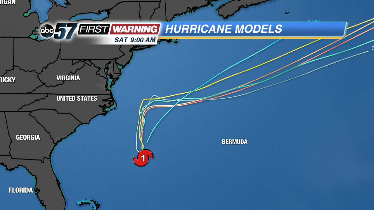 Models showing a northerly track of Maria until the cold front arrives to push the storm farther out into the Atlantic.