Mid-winter thaw brings threat of black ice and fog.
Posted: Jan 8, 2018 4:29 PM EDT

-
1:32

Bridging the healthcare gap in Michiana
-
1:44

Drier but cooler weather returns for Wednesday
-
2:32

County Council asks questions on 900-acre Granger rezoning and...
-
0:56

Notre Dame women’s basketball team holds end-of-season awards...
-
0:45

Idea Week kicks off with networking at launch party
-
2:59

SBPD officer takes in six puppies while SBARC remains on Parvo...
-
1:45

How rain is hampering planting progress
-
2:43

From classrooms to rental units in Chikaming Township
-
1:47

Cooler and drier midweek, milder and wetter weekend
-
2:36

Aspiring chefs are cultivating their dreams at Ivy Tech
-
1:40

Rainy and breezy Tuesday
-
0:58

Hockey team hosts ’Rally for Rudy’ car wash

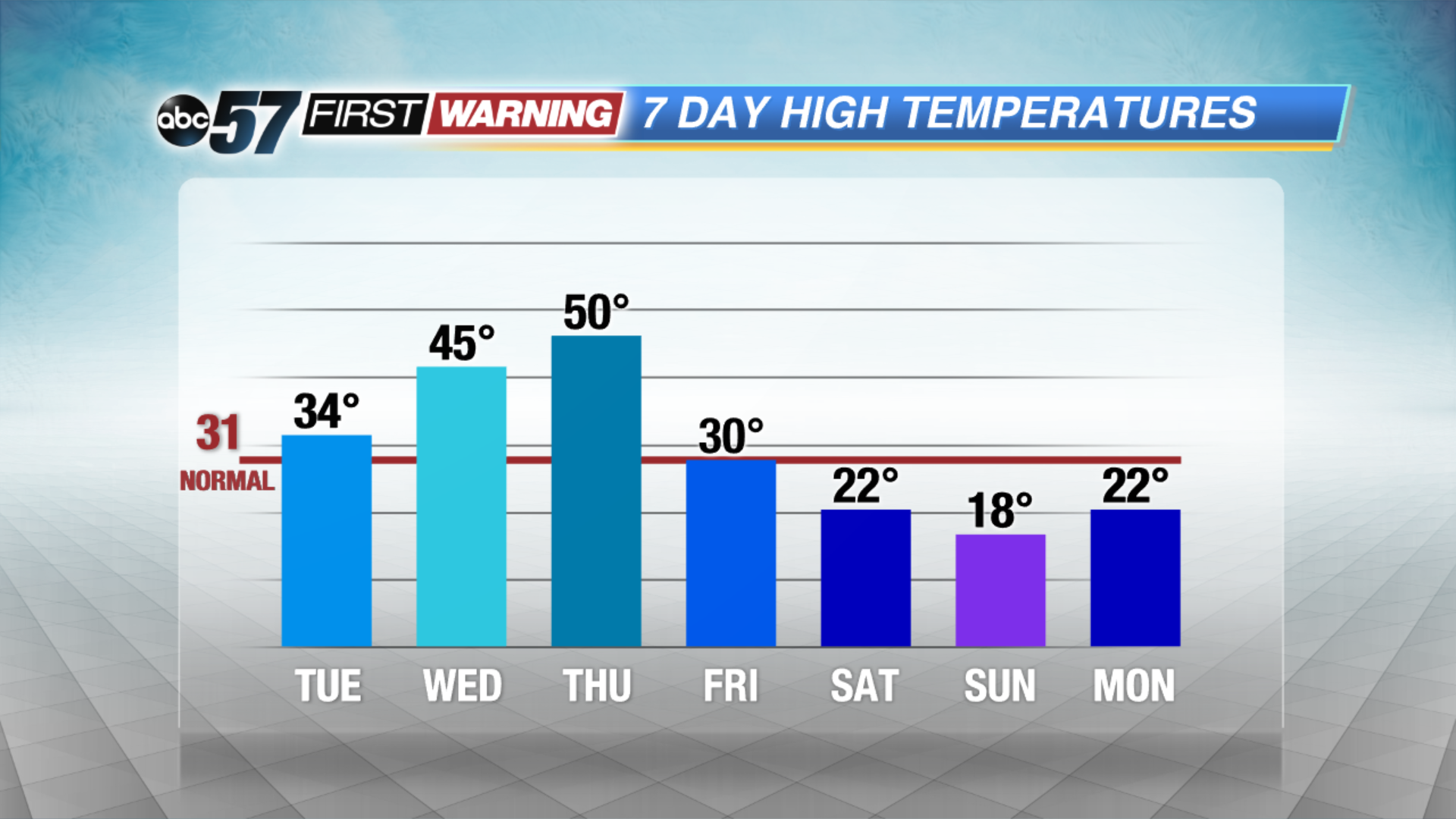
A mid-winter warm-up this week will bring a new set of hazards. The freeze-thaw cycle increases the chance of black ice, fog and potholes, mostly in the morning hours. Highs will rise from just above freezing Tuesday to possibly the 50s on Thursday. We’ll watch for a potential snow-maker later this week before another crash in temperatures this weekend.
Tonight: Partly cloudy with morning fog developing, low 22.
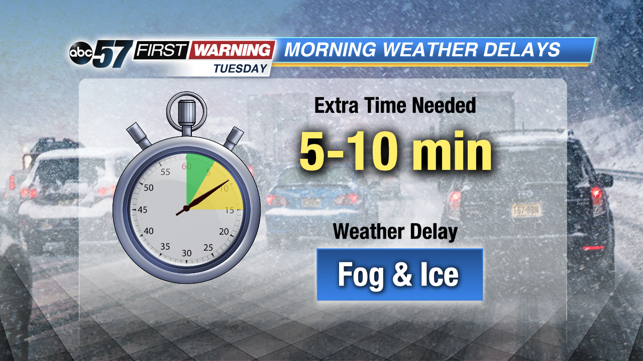 Watch for fog and black ice in the morning
Tuesday: Partly cloudy, high of 34.
Wednesday: Fog and drizzle, high of 45.
Thursday: Rain and fog, highs near 50.
 A quick thaw will melt a lot but not all of our snow pack.
Sign up for the ABC 57Newsletter