Minor winter weather impacts before significant weekend storm

-
2:24

Suspect arrested for allegedly sexually assaulting two girls...
-
0:25

Humane Society of St. Joseph County holds microchip clinic
-
2:58

Pulaski County Community Foundation provides support for childcare...
-
3:14

Green wave of economic growth in Michigan from marijuana dispensaries
-
1:28

Brisk, breezy but beautiful weekend
-
0:48

University Park Mall holding parking-lot carnival this week
-
1:52

While the rain is over, the cooling temperatures are not
-
2:28

Public forum hosted by John Glenn High School students
-
3:34

Kickoff preview with ABC57’s Allison Hayes
-
0:57

Completion of Martin Luther King Jr. Dream Center one step closer
-
0:36

Niles High School students network with local professionals
-
3:59

Political group asks Indiana Democrats to vote in Republican...

The concern for freezing drizzle and fog continues Tuesday night into Wednesday morning. Slick spots are possible as black ice could form on roads.
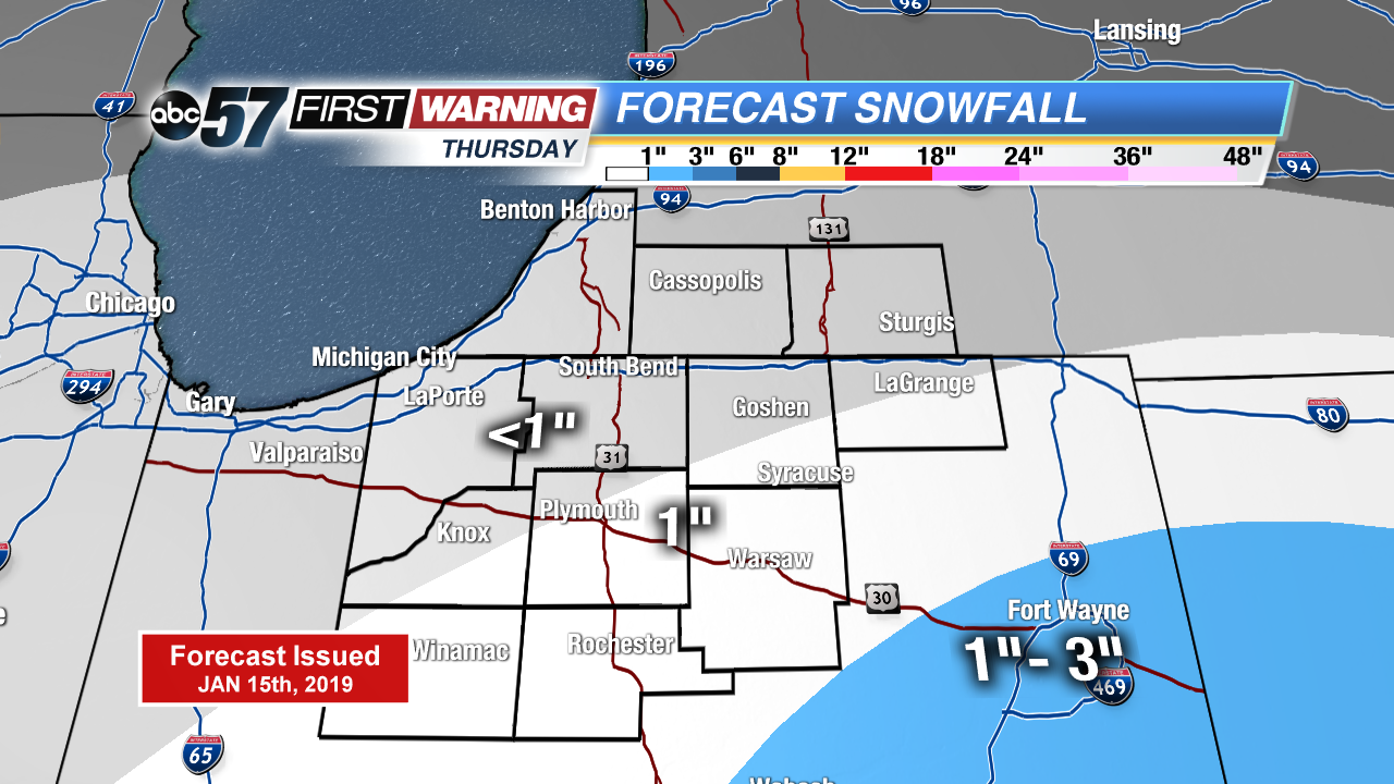
There’s little change in the weather Wednesday, cloudy with highs just peaking above freezing. A weak system brings light snow Thursday, with up to an inch possible. Friday is the lull before the storm. Widespread snow Saturday looks likely, significant snowfall through the Saturday evening. Temperatures fall into the single digits Saturday night and lake effect snow is possible Sunday. The coldest air of the season lasts through early next week.
Tonight: Freezing fog/drizzle possible, cloudy, low of 28.
Wednesday: Cloudy, high of 34.
Thursday: Light snow showers, mostly cloudy, high of 32.
Friday: Mostly cloudy, high of 30.