
-
7:27

Center for the Homeless hosting Dancing With Our Stars
-
2:10

More wet weather arriving later tonight, but sunnier skies after
-
3:16

Public input on the proposal to restart the Palisades Nuclear...
-
1:35

Dari Fair opened Wednesday for 2024 season, temperatures cool...
-
1:22

Another round of rain, then a cool weekend
-
4:33

Should Indiana’s abortion records be public?
-
2:52

Trailblazing promotions at the South Bend Fire Department
-
1:30

Downtown South Bend and Notre Dame to see improved connectivity
-
1:44

Storm threat today holds relatively low severe risk
-
0:30

Officials share opioid settlement funding plan
-
1:04

Bonneyville Mill opens for the 2024 season
-
0:32

Increase in federal funding coming to improve local hiking and...

Winter weather returns, snow showers are likely through Wednesday. The cold northwesterly flow will set up lake effect snow showers during the early morning, when temperatures fall into the 20s. Snow showers wane each afternoon as temperature warm above freezing. Total accumulation of one to three inches is possible over the next three days, the brunt of which is likely Tuesday. Skies clear and temperatures warm to end the week, 50s possible by the weekend.
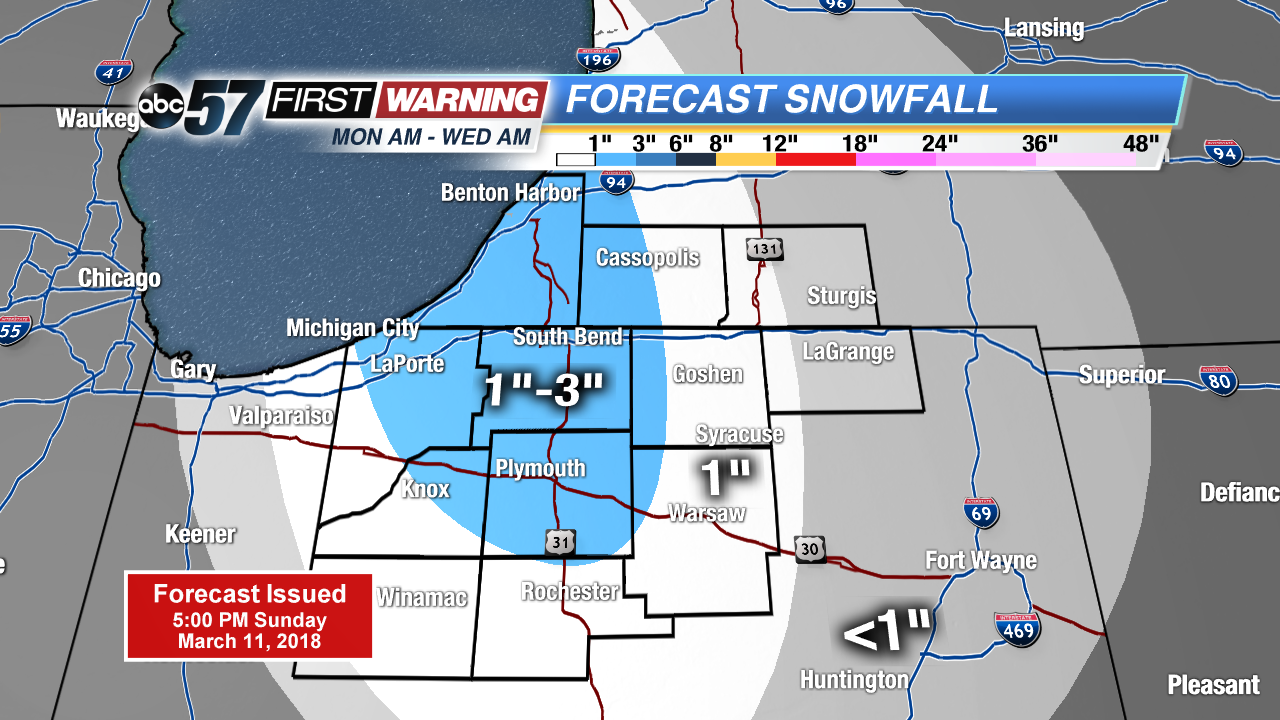
Tonight: Mostly clear, snow by morning, low of 24.
Monday: Mostly cloudy with a chance of scattered snow showers, breezy, high of 36.
Tuesday: Lake effect snow showers, high of 32.
Wednesday: Morning snow showers, highs in the mid-30s.
Sign up for the ABC 57Newsletter