More snow Wednesday, snowy pattern continues
Posted: Dec 12, 2017 4:28 PM EDT

-
1:32

Bridging the healthcare gap in Michiana
-
1:44

Drier but cooler weather returns for Wednesday
-
2:32

County Council asks questions on 900-acre Granger rezoning and...
-
0:56

Notre Dame women’s basketball team holds end-of-season awards...
-
0:45

Idea Week kicks off with networking at launch party
-
2:59

SBPD officer takes in six puppies while SBARC remains on Parvo...
-
1:45

How rain is hampering planting progress
-
2:43

From classrooms to rental units in Chikaming Township
-
1:47

Cooler and drier midweek, milder and wetter weekend
-
2:36

Aspiring chefs are cultivating their dreams at Ivy Tech
-
1:40

Rainy and breezy Tuesday
-
0:58

Hockey team hosts ’Rally for Rudy’ car wash

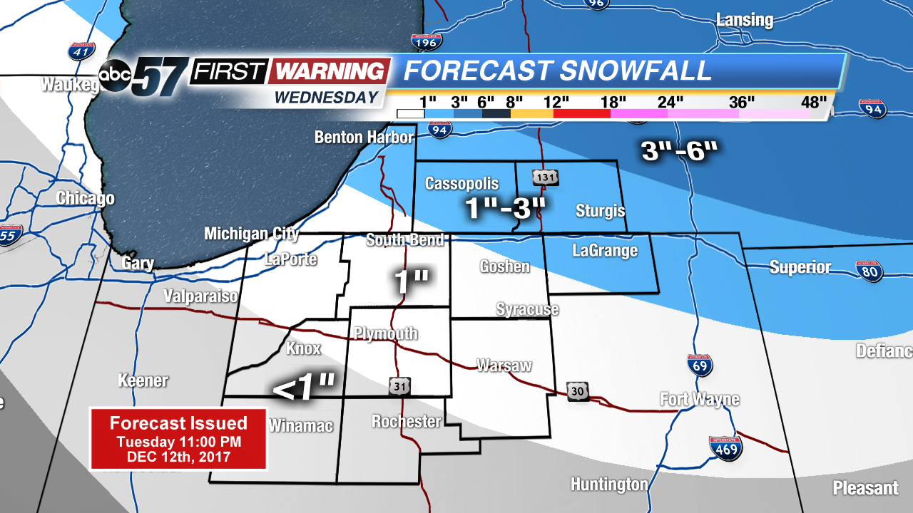 Updated snowfall forecast for Wednesday
Lake effect snow showers will come to an end this evening. Treated roads may turn icy and slick and low drop into the teens tonight.
More system snow Wednesday, this will bring a quick one to three inches for most of Michiana. The pattern stays snowy and cold through the end of the week. The pattern finally breaks this weekend with temperatures warming above freezing. There is a chance of wintry mix Sunday before skies clear and temperatures continue to warm next week.
Tonight: Lake effect snow ending, low 15.
Wednesday: Scattered snow showers, high of 28.
Thursday: Scattered snow showers, high or 24.
Friday: Scattered snow showers, highs near 30.
Sign up for the ABC 57Newsletter