Periods of heavy lake effect snow

-
1:21

Fair Thursday wet / windy weekend
-
1:32

Bridging the healthcare gap in Michiana
-
1:44

Drier but cooler weather returns for Wednesday
-
2:32

County Council asks questions on 900-acre Granger rezoning and...
-
0:56

Notre Dame women’s basketball team holds end-of-season awards...
-
0:45

Idea Week kicks off with networking at launch party
-
2:59

SBPD officer takes in six puppies while SBARC remains on Parvo...
-
1:45

How rain is hampering planting progress
-
2:43

From classrooms to rental units in Chikaming Township
-
1:47

Cooler and drier midweek, milder and wetter weekend
-
2:36

Aspiring chefs are cultivating their dreams at Ivy Tech
-
1:40

Rainy and breezy Tuesday

Lake effect snow showers continue through today, creating for slick roads and low visibility at times on the roadways. Give yourself at least 10-15 extra ![]() Very high threat to travel in SW Michigan.
Very high threat to travel in SW Michigan.
A couple flurries are possible Saturday morning but most of the day is dry with partly cloudy skies. It’ll be a great day to run any errands or clean up the snow because a wintry system moves in 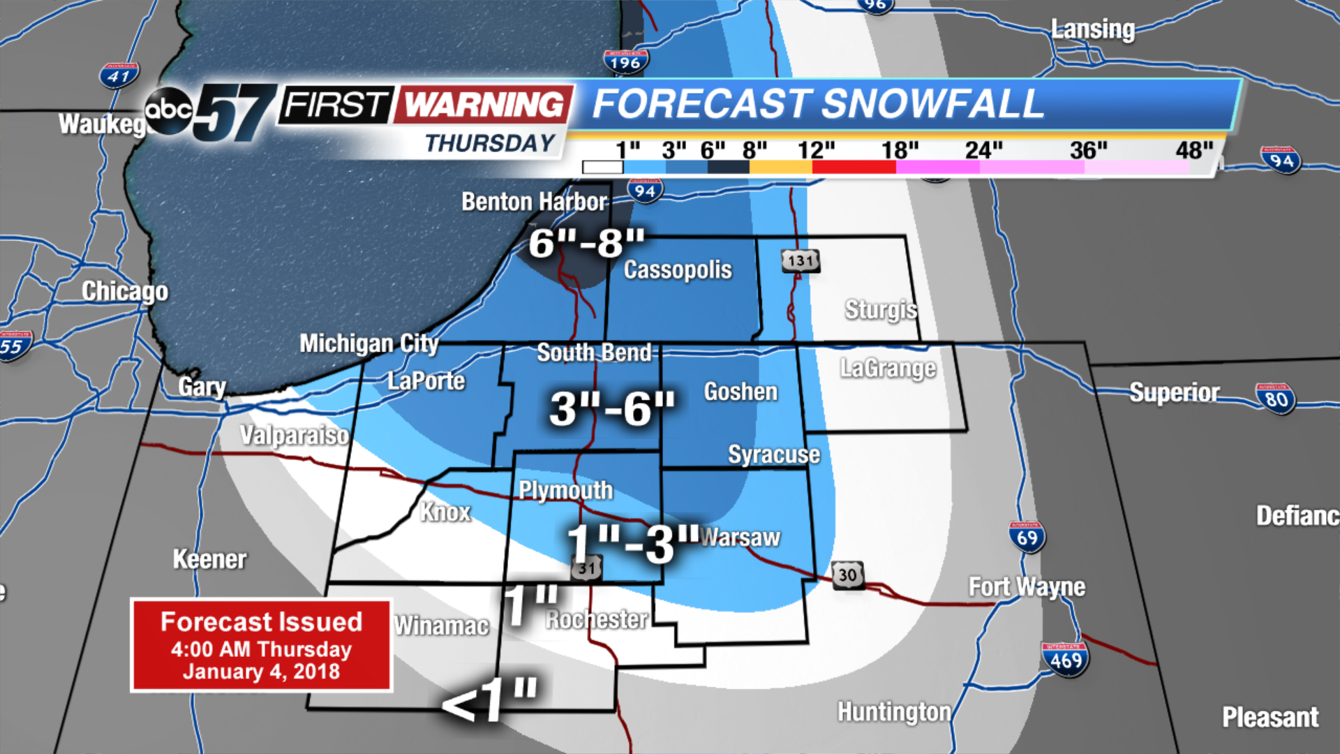 Thursday estimated snowfall total
Today: Lake effect snow showers, high of 14, falling PM temperatures.
Tonight: Lake effect snow showers, low of 4.
Friday: Lake effect snow showers, high of 10.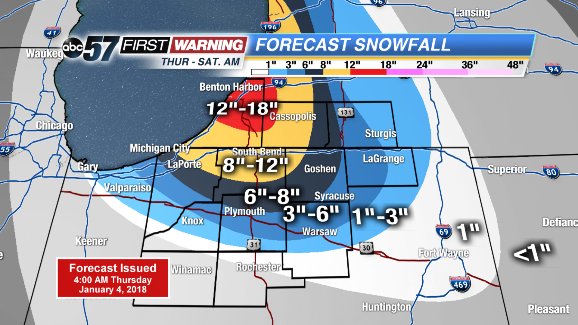 NEW estimated snowfall totals Thursday through Saturday AM.
Saturday: Partly cloudy, high of 15.