Scattered showers and storms - Flooding Concerns

-
7:27

Center for the Homeless hosting Dancing With Our Stars
-
2:10

More wet weather arriving later tonight, but sunnier skies after
-
3:16

Public input on the proposal to restart the Palisades Nuclear...
-
1:35

Dari Fair opened Wednesday for 2024 season, temperatures cool...
-
1:22

Another round of rain, then a cool weekend
-
4:33

Should Indiana’s abortion records be public?
-
2:52

Trailblazing promotions at the South Bend Fire Department
-
1:30

Downtown South Bend and Notre Dame to see improved connectivity
-
1:44

Storm threat today holds relatively low severe risk
-
0:30

Officials share opioid settlement funding plan
-
1:04

Bonneyville Mill opens for the 2024 season
-
0:32

Increase in federal funding coming to improve local hiking and...

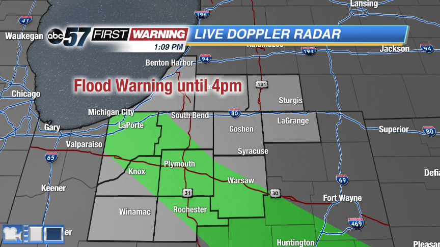
A line of severe storms already made it's way through Michiana this morning. There are still a couple isolated strong cells north of US-30 with gusty winds and hail. Storms redevelop this afternoon, which could become strong with an isolated severe storm possible. The main threats are strong winds, hail and heavy rain. How much sunshine we still will dictate whether or not storms become severe. The wet weather clears out around dinner time with just a chance of an isolated shower overnight.
This weekend quiets down with plenty of sunshine both days. Highs are cool for this time of year on Saturday, only topping out in the middle 70s. It warms back up near 80 for Sunday.
Friday: A few rounds of storms through midday, strong to severe possible, high 82.
Tonight: Clearing skies, low of 58.
Saturday: Sunny, highs in the mid-70s.
Sunday: Mostly sunny, highs near 80.