Severe storm update Wednesday afternoon

-
0:54

Goodwill ’Little Black Dress’ event raises funds for community...
-
1:45

Cheers Bar and Grill liquor license renewed following controversy
-
2:40

Kyle Rudolph weighs in on fellow Irish, Joe Alt, ahead of NFL...
-
0:58

Contractors prepare bids for multi-million-dollar Four Winds...
-
3:11

Caleb Williams and Marvin Harrison Jr. weigh in on upcoming draft
-
3:18

New settlement with Indiana allows Landmark to apply for recertification
-
2:32

NFL Analysts break down Joe Alt’s stock
-
1:21

Fair Thursday wet / windy weekend
-
2:52

Union Township sues UNAS over ambulance stripped for parts
-
1:32

Bridging the healthcare gap in Michiana
-
1:44

Drier but cooler weather returns for Wednesday
-
2:32

County Council asks questions on 900-acre Granger rezoning and...

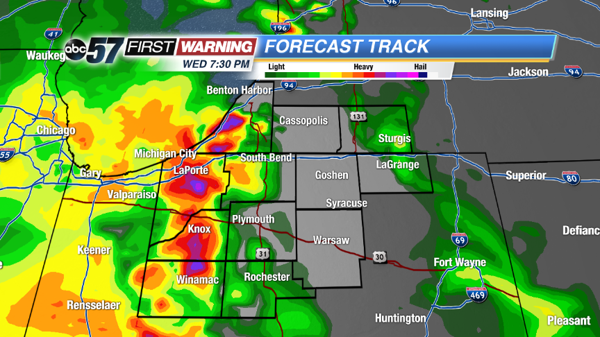 The same run of Forecast Track shows another round after 7 p.m.
The hot and humid weather will help to fuel scattered showers and storms this afternoon and evening. Some storms could become strong to severe with damaging winds, hail and heavy rain possible. A determining factor in storm strength will be development to our west and how much cloud cover we see ahead of storms. There could a an early round of scattered storms after 4 p.m. followed by a second round after 7 p.m.
We’ll dry out some during the overnight hours, but more morning rain is possible tomorrow. Skies become partly sunny for the second half of Thursday with more storms chances into the weekend.
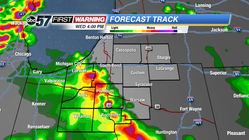 Hi-Res run of Forecast Track shows the first round of scattered storms around 4 p.m. moving in from the southwest.
Tonight: Scattered showers and storms. Some could be strong to severe. Lows near 70.
Thursday: Morning showers and storms then partly sunny, high in the upper 80s.
Friday: PM scattered storms, highs in the upper 80s.
Saturday: More scattered showers and storms, highs in the upper 80s.