Heavy rain and flood threat overnight.

-
2:11

Students gearing up for local careers in Manufacturing
-
2:13

Sunny today, but expect a wetter and warmer weekend
-
0:54

Goodwill ’Little Black Dress’ event raises funds for community...
-
1:45

Cheers Bar and Grill liquor license renewed following controversy
-
2:40

Kyle Rudolph weighs in on fellow Irish, Joe Alt, ahead of NFL...
-
0:58

Contractors prepare bids for multi-million-dollar Four Winds...
-
3:11

Caleb Williams and Marvin Harrison Jr. weigh in on upcoming draft
-
3:18

New settlement with Indiana allows Landmark to apply for recertification
-
2:32

NFL Analysts break down Joe Alt’s stock
-
1:21

Fair Thursday wet / windy weekend
-
2:52

Union Township sues UNAS over ambulance stripped for parts
-
1:32

Bridging the healthcare gap in Michiana

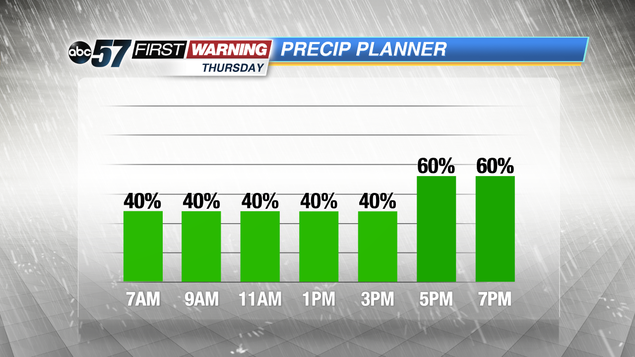
Update 10 PM -- After strong storms, heavy rain continues overnight. Storms could be loud but are unlikely to be severe. Be aware of flooded roads or downed limbs in the morning.
The chance of showers and thunderstorms increases overnight through Thursday morning. A few cells could produce strong wind gusts or hail.
Showers and thunderstorms are likely through Thursday and into Friday morning. This is much needed rain that could bring more than an inch in total with higher amounts under thunder cells. The forecast stays muggy through Friday morning, before a front clears skies and drops the humidity Friday afternoon. The weekend looks mostly fair with a small chance of rain Sunday.
Tonight: Chance of showers and storms, low of 64.
Thursday: Showers and thunderstorms likely, high of 76.
Friday: Showers likely through noon, high of 70.
Saturday: Sunny, high of 70.