Snow starts again Monday

-
2:28

Public forum hosted by John Glenn High School students
-
3:34

Kickoff preview with ABC57’s Allison Hayes
-
0:57

Completion of Martin Luther King Jr. Dream Center one step closer
-
0:36

Niles High School students network with local professionals
-
3:59

Political group asks Indiana Democrats to vote in Republican...
-
3:01

New Buffalo Area Schools to build workforce housing
-
2:37

City seeks feedback for final Potawatomi Park plan
-
7:27

Center for the Homeless hosting Dancing With Our Stars
-
2:10

More wet weather arriving later tonight, but sunnier skies after
-
3:16

Public input on the proposal to restart the Palisades Nuclear...
-
1:35

Dari Fair opened Wednesday for 2024 season, temperatures cool...
-
1:22

Another round of rain, then a cool weekend

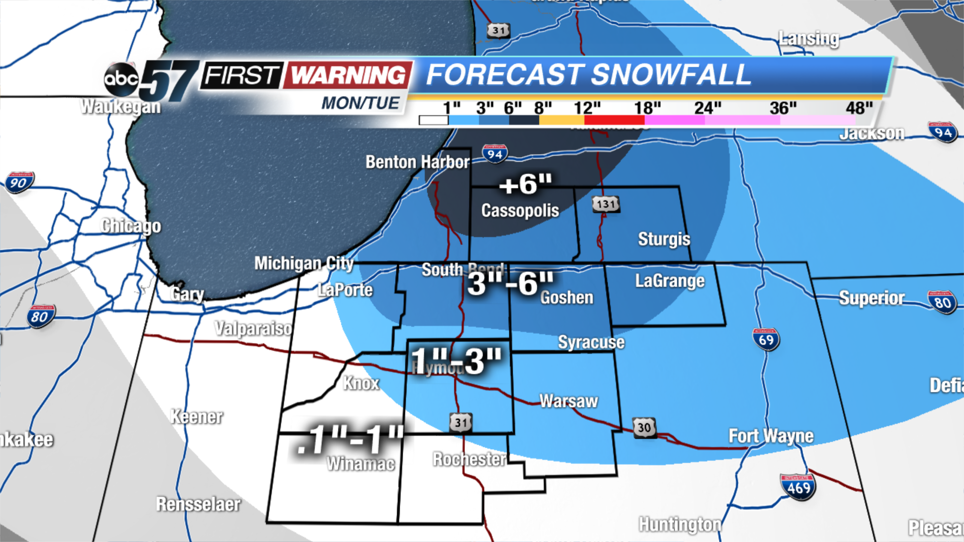
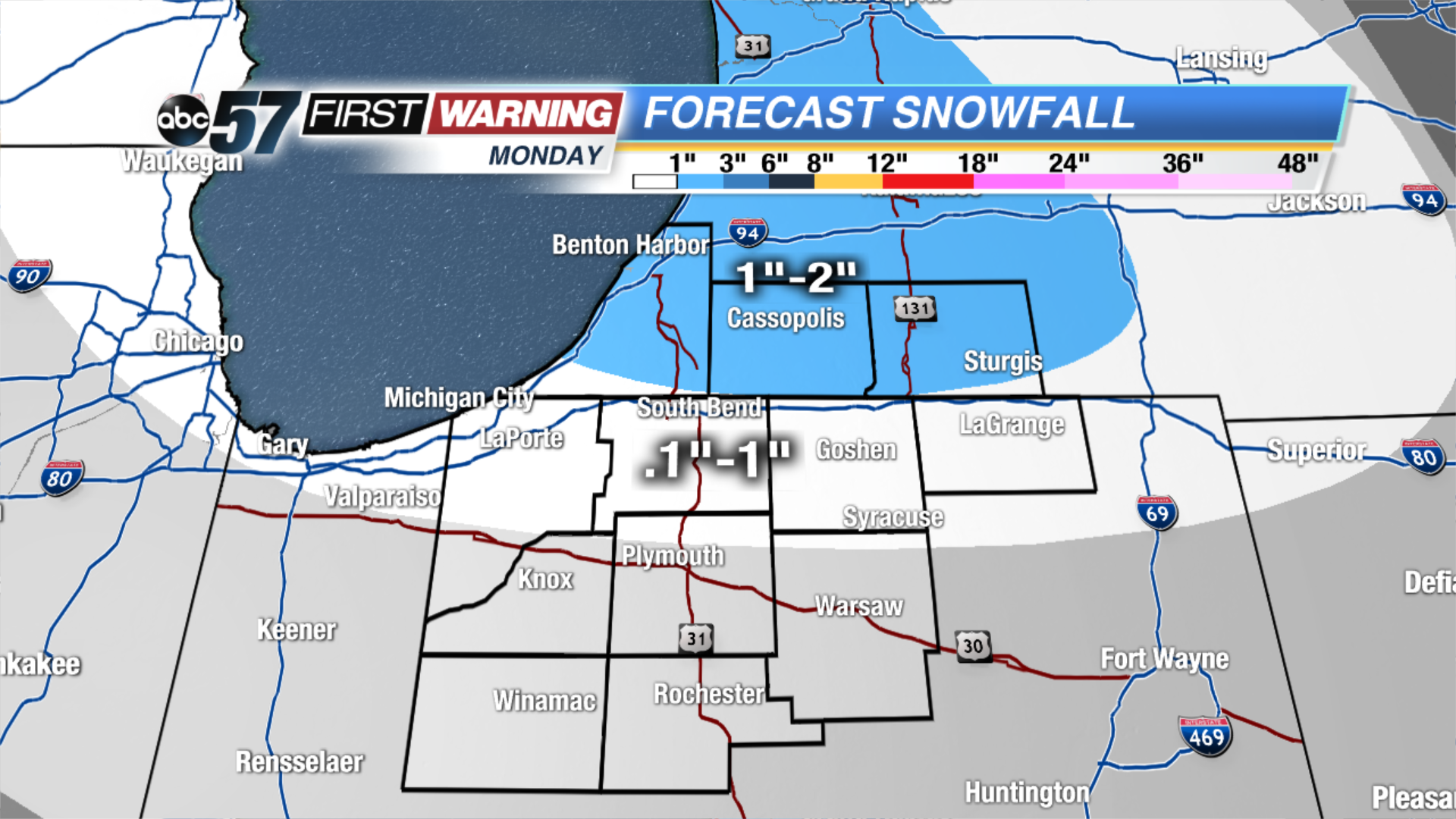
We have a snowy week ahead of us! The next winter system will bring snow showers and then lake effect snow, starting Monday and lasting until Wednesday. The system will bring light snow showers during the midday on Monday, mainly for our Michigan counties, and far northern Indiana counties. The snow will intensify for this area during the evening. Then, on Tuesday, a lake effect snow band will develop in the north/south direction. This will bring the snow further south to parts of Starke, Marshall, and Kosciusko counties.
Overall from Monday through early Wednesday morning, up 5-almost 8” will fall for Berrien and Cass counties. 3-5” for parts of Berrien, LaPorte, St. Joseph (IN), Elkhart, LaGrange, and St. Joseph (MI) counties. 1-3” for the northeast corner of Starke, Marshall, Kosciusko and eastern LaGrange counties. Less than or equal to 1” for parts of Starke, Pulaski, Fulton and far south Kosciusko counties.
Tonight: Mostly cloudy. Flurries possible. Low of 22.
Monday: Mostly cloudy with snow showers developing midday. High of 34.
Tuesday: Mostly cloudy with L.E. snow. Highs in the mid 20s.