
-
2:24

Suspect arrested for allegedly sexually assaulting two girls...
-
0:25

Humane Society of St. Joseph County holds microchip clinic
-
2:58

Pulaski County Community Foundation provides support for childcare...
-
3:14

Green wave of economic growth in Michigan from marijuana dispensaries
-
1:28

Brisk, breezy but beautiful weekend
-
0:48

University Park Mall holding parking-lot carnival this week
-
1:52

While the rain is over, the cooling temperatures are not
-
2:28

Public forum hosted by John Glenn High School students
-
3:34

Kickoff preview with ABC57’s Allison Hayes
-
0:57

Completion of Martin Luther King Jr. Dream Center one step closer
-
0:36

Niles High School students network with local professionals
-
3:59

Political group asks Indiana Democrats to vote in Republican...

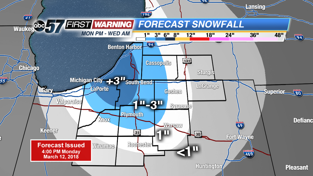
Snow squalls intensify after midnight, accumulation of more than three inches is possible in parts of Berrien, La Porte and St. Joseph counties. Greatest concern will be slick roads for the morning drive Tuesday.
Snowy start to Tuesday, roads may be slick with a few inches on the ground and a coating of snow or slush on the roads. Snow showers wane a bit during the day as temperatures warm towards the freezing mark. Snow showers may bring an additional inch Tuesday night as temperatures fall back into the 20s. Sunshine and a slow warm-up are in store the rest of the week.
Tonight: Lake effect snow showers, low 26.
Tuesday: Lake effect snow showers, high of 32.
Wednesday: Morning snow showers, high of 38.
Thursday: Mostly sunny, highs in the low 40s.