Storms possible through midday Friday
Posted: Jul 6, 2017 11:48 PM EDT

-
3:01

New Buffalo Area Schools to build workforce housing
-
7:27

Center for the Homeless hosting Dancing With Our Stars
-
2:10

More wet weather arriving later tonight, but sunnier skies after
-
3:16

Public input on the proposal to restart the Palisades Nuclear...
-
1:35

Dari Fair opened Wednesday for 2024 season, temperatures cool...
-
1:22

Another round of rain, then a cool weekend
-
4:33

Should Indiana’s abortion records be public?
-
2:52

Trailblazing promotions at the South Bend Fire Department
-
1:30

Downtown South Bend and Notre Dame to see improved connectivity
-
1:44

Storm threat today holds relatively low severe risk
-
0:30

Officials share opioid settlement funding plan
-
1:04

Bonneyville Mill opens for the 2024 season

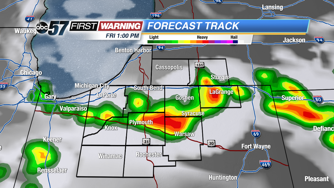 Short-Range RPM model with storms firing around 1 PM Friday.
Big changes in how storms look to develop Friday morning. A front that was expected to bring storms early is expected to stall overnight. The fewer showers we see early, the more likely storms could fire around noon Friday. Michiana will now be the starting point for storms Friday versus the ending point for Thursday night's storms. This scenario would still keep our severe threat low but storms could still bring heavy rain and gusty wind. Storms clear by mid afternoon and the humidity drops into Saturday.
Sign up for the ABC 57Newsletter