
-
2:24

Suspect arrested for allegedly sexually assaulting two girls...
-
0:25

Humane Society of St. Joseph County holds microchip clinic
-
2:58

Pulaski County Community Foundation provides support for childcare...
-
3:14

Green wave of economic growth in Michigan from marijuana dispensaries
-
1:28

Brisk, breezy but beautiful weekend
-
0:48

University Park Mall holding parking-lot carnival this week
-
1:52

While the rain is over, the cooling temperatures are not
-
2:28

Public forum hosted by John Glenn High School students
-
3:34

Kickoff preview with ABC57’s Allison Hayes
-
0:57

Completion of Martin Luther King Jr. Dream Center one step closer
-
0:36

Niles High School students network with local professionals
-
3:59

Political group asks Indiana Democrats to vote in Republican...

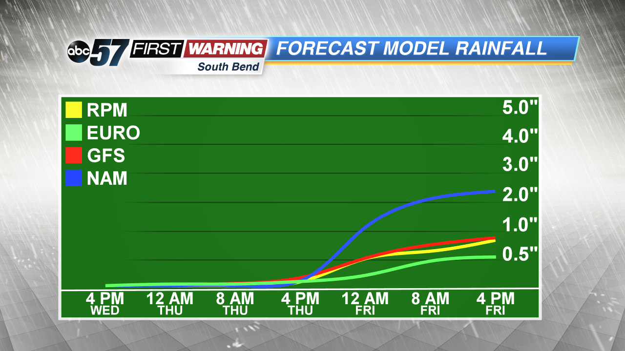
The wet weather pattern continues this week with more showers and storms Thursday, Friday and early Saturday. A slow-moving low pressure system crawls across the Midwest to end the week, keeping the threat of heavy rain and flooding in the forecast. High temperatures will be cooler than normal in the 70s but with the dewpoint in the mid-60s it will still feel damp/muggy. We clear and dry gradually through the weekend.
Tonight: Mostly cloudy, low of 62.
Thursday: Scattered showers and storms high of 76.
Friday: Scattered showers and storms, high of 74.
Saturday: AM showers, high of 72.
Sign up for the ABC 57Newsletter