The deep freeze begins, snowy pattern ahead

-
1:26

Brisk but beautiful weekend
-
5:15

ABC57’s Arts and Acts: All-American Rejects comes to South...
-
2:08

Whirlpool and Lake Michigan College host second Girls Rock IT...
-
2:24

Suspect arrested for allegedly sexually assaulting two girls...
-
0:25

Humane Society of St. Joseph County holds microchip clinic
-
2:58

Pulaski County Community Foundation provides support for childcare...
-
3:14

Green wave of economic growth in Michigan from marijuana dispensaries
-
1:28

Brisk, breezy but beautiful weekend
-
0:48

University Park Mall holding parking-lot carnival this week
-
1:52

While the rain is over, the cooling temperatures are not
-
2:28

Public forum hosted by John Glenn High School students
-
3:34

Kickoff preview with ABC57’s Allison Hayes

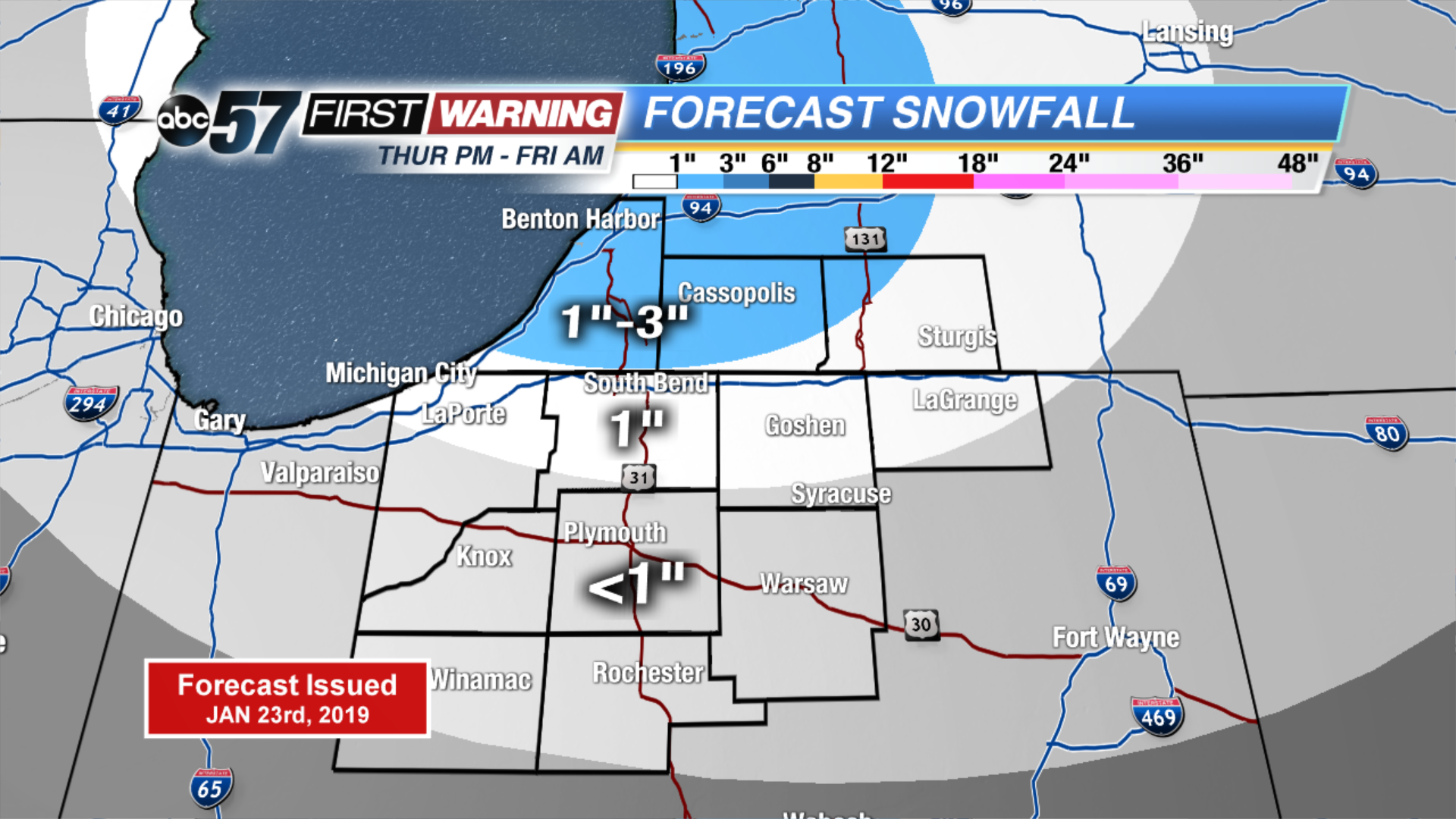
The deep freeze begins Thursday, with subfreezing temperatures for the foreseeable future, some nights will fall below zero. The first of many rounds of snow starts Thursday afternoon, a weak clipper will bring a range of one to three inches to the lake effect zones. More of the same through the weekend, systems spacing themselves by roughly 24 hours apart. Monday snow might be the most widespread and impactful snow but that will come down to the track of the storm. Stay tuned and stay warm, the heart of winter is here.
Tonight: Mostly cloudy with a chance of snow showers. Low of 16.
Thursday: Mostly cloudy with snow showers starting in the evening. High of 24.
Friday: Morning snow showers. High of 8.
Saturday: Morning show showers. High of 16.