Winter Storm moves in tonight

-
1:44

Drier but cooler weather returns for Wednesday
-
2:32

County Council asks questions on 900-acre Granger rezoning and...
-
0:56

Notre Dame women’s basketball team holds end-of-season awards...
-
0:45

Idea Week kicks off with networking at launch party
-
2:59

SBPD officer takes in six puppies while SBARC remains on Parvo...
-
1:45

How rain is hampering planting progress
-
2:43

From classrooms to rental units in Chikaming Township
-
1:47

Cooler and drier midweek, milder and wetter weekend
-
2:36

Aspiring chefs are cultivating their dreams at Ivy Tech
-
1:40

Rainy and breezy Tuesday
-
0:58

Hockey team hosts ’Rally for Rudy’ car wash
-
1:06

South Bend School Board of Trustees reviewing the code of conduct

We are off to a cold but quiet start this morning. Most of the roads are much clearer and it remains calm for today. There is just a chance for a flurry or two but most won’t have to deal with any snow. The winter storm moves in Thursday night lasting throughout Friday, into Friday night. Winter Storm Watch is already posted for most of Michiana. Heavy snow, low visibility and rough travel conditions are expected. Well over 6” of snow is likely for northern Michiana. Exactly who gets the most snow will depend on the track the storm makes. Snow chances continue into the weekend but next week is much quieter.
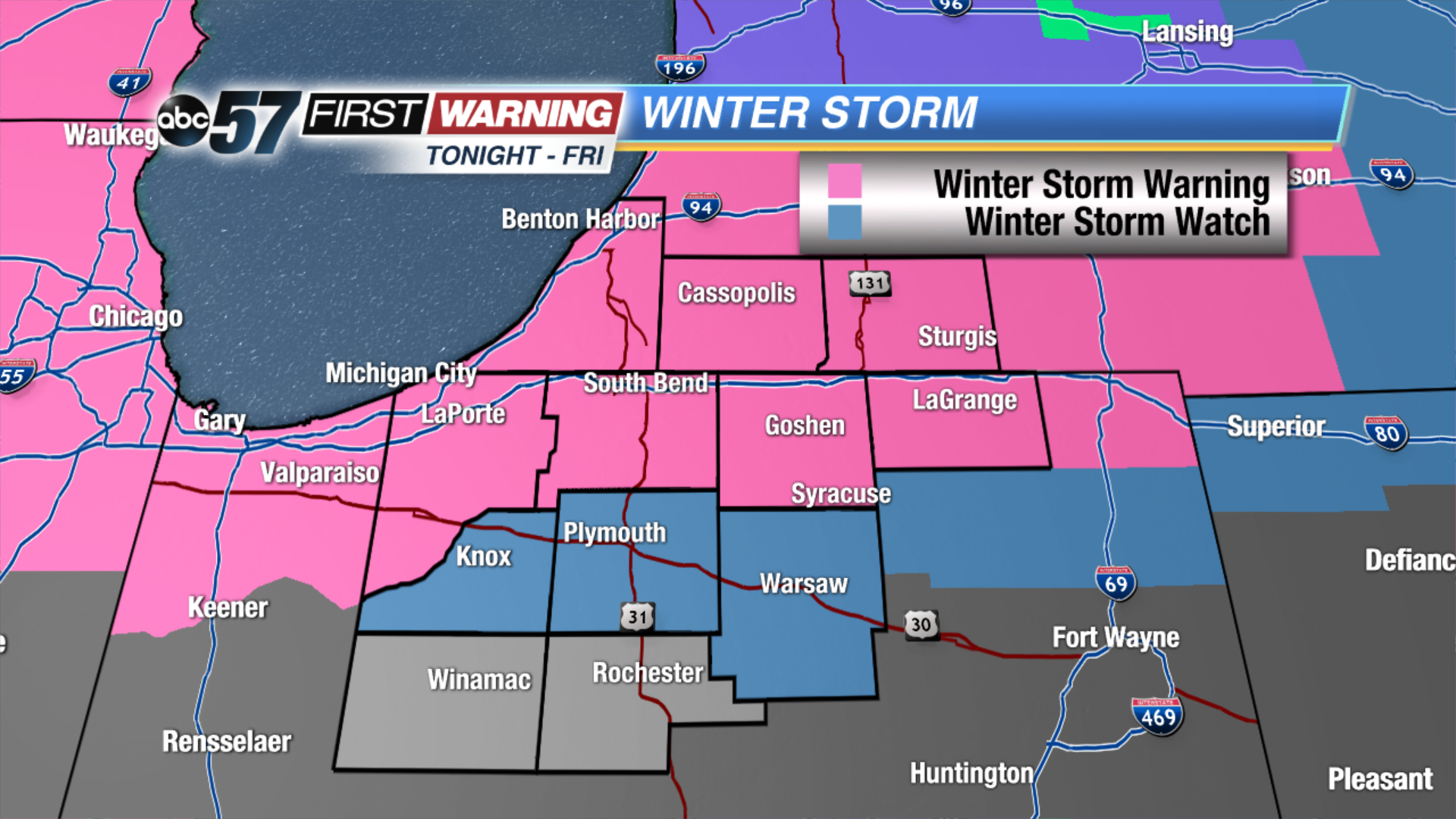 Winter Storm Warnings and Watches posted for tonight through Friday night
Thursday: Mostly to partly cloudy, chance of snow, high of 20.
Tonight: Heavy snow begins, low of 18.
Friday: Heavy snow, highs near 30.
Saturday: Mostly cloudy, chance of PM snow, highs in the upper 20s.
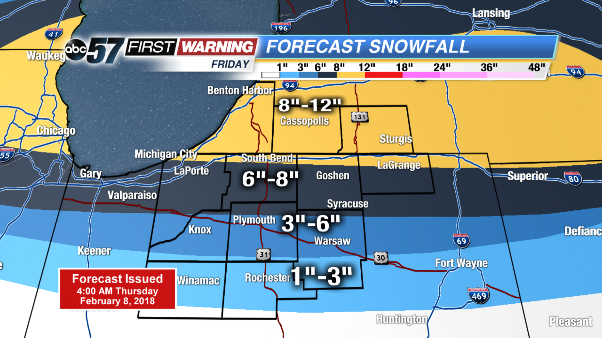 Forecast snowfall totals for Friday.