
-
4:24

Michiana Crime Stopper shredding event
-
1:16

’IvyCares’ program setting students up for success in and...
-
1:45

Windy and wet this weekend, but unseasonable warmth as well
-
3:13

Local players react to $3 million investment in Byer Softball...
-
0:32

Layoffs at Whirlpool could affect workers in Benton Harbor
-
1:03

Annual District Sisterhood Conference at Ivy Tech empowers students
-
1:49

Back home in downtown South Bend, YMCA to open new location
-
2:16

This week’s ABC57 Cub Reporter is Nicholas Zentz
-
3:05

Amazon Web Services invests $11 billion to build data center...
-
4:05

Riley High School student center stage at the NFL Draft
-
1:35

Rain, wind, and milder temperatures forecast this weekend
-
2:49

Joe Alt expected to be drafted in the first round of NFL Draft

Storms likely along and a head of a cold through that will sweep through Michiana this evening. Focus will be where storms initialize. The farther northwest storms fire, the greater storms could be strong for all of Michiana. If storms fire more south and east, severe threat shifts higher towards Ft. Wayne.
Feeling fall-like this week as temperatures struggle to break 70. Fair but breezy Tuesday and much cooler midweek, with highs in the mid-60s. The northwest flow will produce lake effect clouds and rain showers, as air temps will be in the 60s and water temps are still in the 70s. Next weekend, fair and milder weather returns.
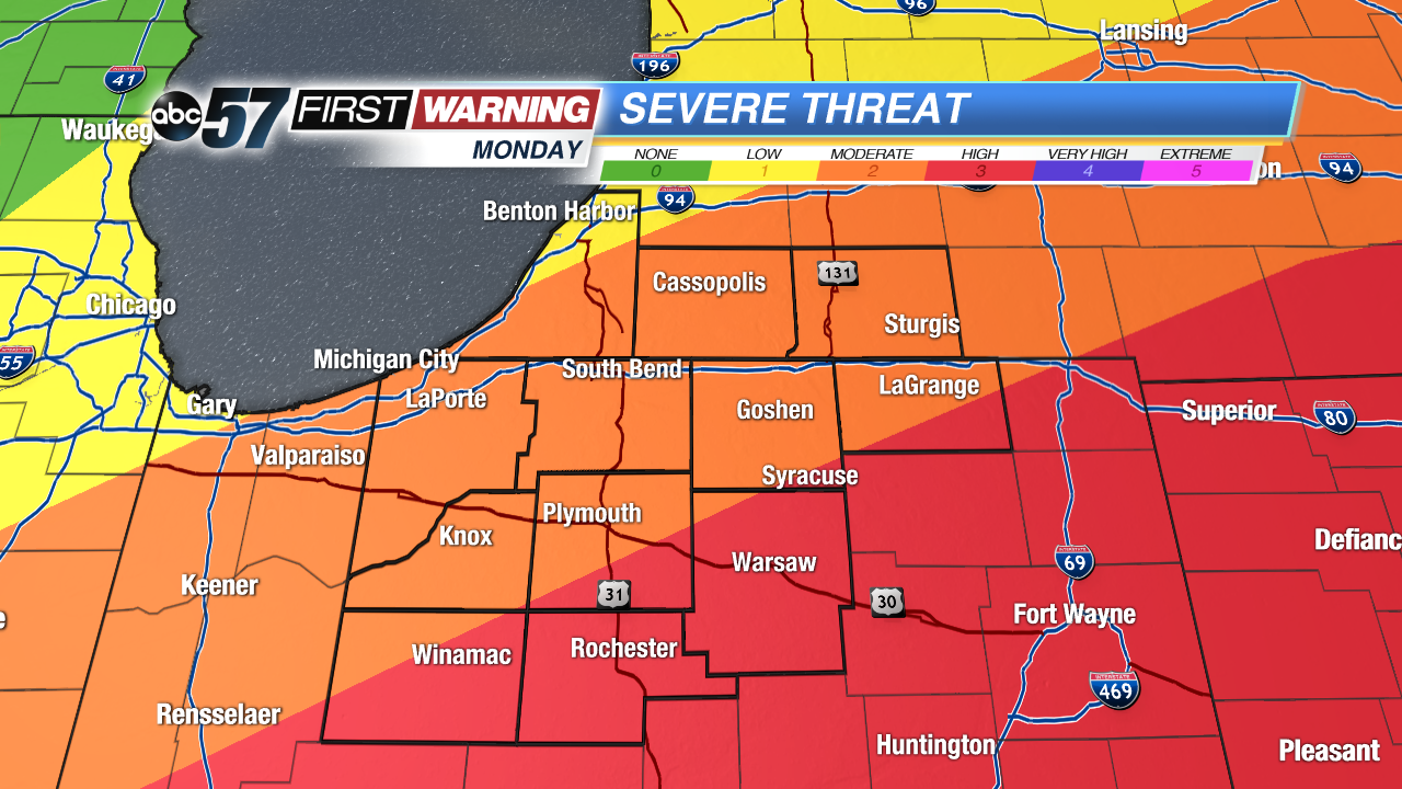 The farther south and east you live the greater the severe threat. The closer to Warsaw you live the more likely storms could be strong.
Tonight: Evening storms, then clearing and cooling, low of 56.
Tuesday: Mostly sunny to partly cloudy, high of 70.
Wednesday: Mostly cloudy with showers likely, high of 64.
Thursday: Partly cloudy, a chance of showers, highs in the mid-60s.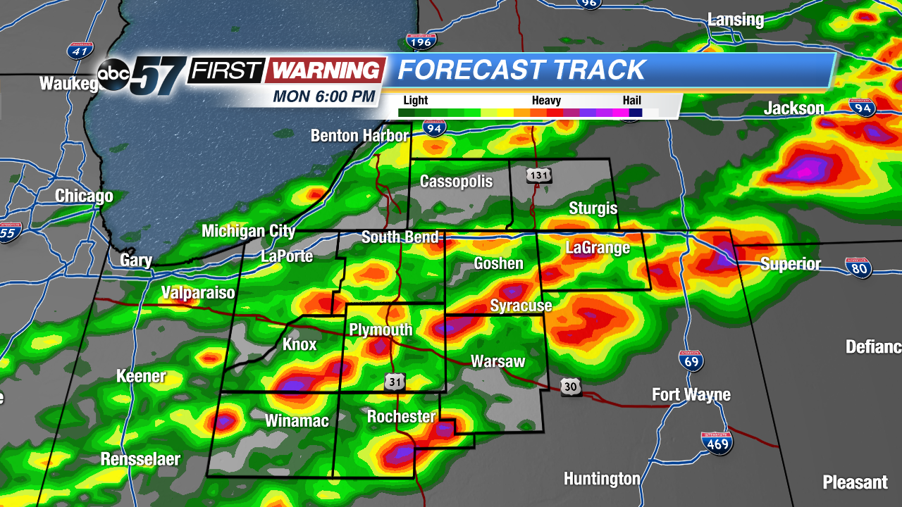 High resolution models pinpoint a quick initialization of storms. Most likely time frame between 5 PM and 7 PM.