

-
1:32

Widespread 90s start today
-
0:57

Warmer stepping out the door
-
3:52

Hyperscale CEO hears residents concerns over expanding Dowagiac...
-
0:50

City of South Bend addresses trouble some short-term rentals
-
1:56

Lake Michigan Hills celebrates its 66th annual Chamber Golf Outing
-
1:56

Fun and 4H at the LaGrange County Fair
-
1:44

La Porte County workers take precautions during this week’s...
-
2:23

Mark Quatrani’s standout season at Notre Dame ends with selection...
-
2:50

Jack Radel becomes Notre Dame’s highest MLB draft pick in more...
-
2:38

Explosive diarrhea cases on the rise in Michigan
-
3:44

Investigation into Friday’s State Trooper shooting under investigation,...
-
3:30

Law enforcement officers react to rash of NW Indiana officers...

Winter is back for the weekend. Lake effect snow could bring more than an inch of snow to the grass through Saturday morning, as the temperature struggles to break the freezing mark. The wind chill Saturday morning will be in the teens and gusts top 30 mph. Sunday is colder, as temperatures stay below freezing most the day. In typical March fashion the chilly weather lasts until Wednesday, then spikes into the 60s before falling again to end next week.
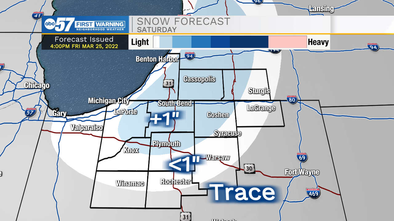
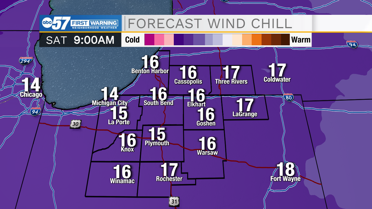
Tonight: Rain then snow showers. Windy. Low 30.
Saturday: Snow showers/flurries. Windy. High 34.
Sunday: Partly cloudy. Breezy. High 32.
Monday: Partly cloudy. High 42.
Sign up for the ABC 57 Newsletter