
-
4:51

Neighbors, Mayor of Benton Harbor differ on Jean Klock Park safety...
-
6:39

ABC57’s Brian Conybeare interviewed Governor Mike Braun with...
-
2:15

Chet Waggoner All-Stars make history, seek community support...
-
2:41

Zimmy’s Tavern engulfed in flames during early Tuesday morning...
-
1:46

Portage Township, ’We Make Indiana’ team up on new housing...
-
0:49

One man in serious condition after fire at Cass County bar
-
2:12

South Bend City Council passes resolution urging pause on Midwest...
-
0:46

Niles City Council vote yes on putting marijuana question on...
-
0:29

Multiple Fire Departments battle residential fire in Berrien...
-
2:10

Notre Dame men’s basketball embracing urgency as Shrewsberry...
-
2:37

Local Beef-A-Roo employees still owed paychecks as private equity...
-
1:42

More storms through 8:00 p.m.

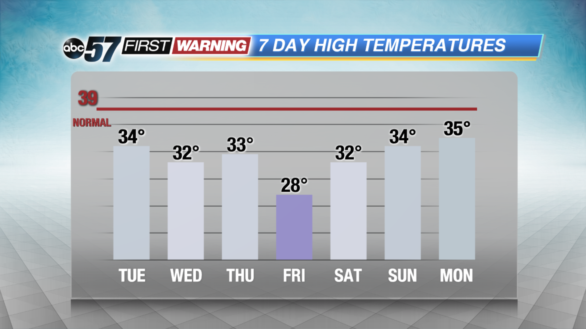
Another cold week, below normal temperatures continue through the weekend as highs will struggle to break the freezing mark. Light snow showers are possible, the best chance of snow is Thursday with a cold front but no major snow is expected at this time. The weekend remains cold but fair, there are signs of milder temperatures next week.
Tonight: Light lake effect snow (mostly west), low of 25.
Tuesday: Mostly cloudy, lake effect snow showers, high of 34.
Wednesday: Partly cloudy, high of 32.
Thursday: Cloudy, snow showers, high of 33.
Sign up for the ABC 57 Newsletter