Another night subzero before a slight warm-up

-
0:54

61st annual Salvation Army Pancake Day held
-
5:26

Rep. Rudy Yakym calling for the protection of Jewish students...
-
1:26

Wet, warm & windy this weekend
-
4:24

Michiana Crime Stoppers shredding event
-
1:16

’IvyCares’ program setting students up for success in and...
-
1:45

Windy and wet this weekend, but unseasonable warmth as well
-
3:13

Local players react to $3 million investment in Byer Softball...
-
0:32

Layoffs at Whirlpool could affect workers in Benton Harbor
-
1:03

Annual District Sisterhood Conference at Ivy Tech empowers students
-
1:49

Back home in downtown South Bend, YMCA to open new location
-
2:16

This week’s ABC57 Cub Reporter is Nicholas Zentz
-
3:05

Amazon Web Services invests $11 billion to build data center...

Nearly as cold or colder tonight, clouds will break, which will mean lows plummeting to or below zero, except closer to Lake Michigan.
There is a slight warm-up to end the week but high temperatures are unlikely to break 20. Light snow showers also stay in the forecast, accumulation of more than one inch each day is unlikely. A reinforcing punch of arctic air is set to impact the central and eastern U.S. for New Year’s Day, temperature will likely dive below zero to start 2018. A break from this frigid pattern still shows up in the models for mid-January.
Tonight: Partly cloudy, flurries, lows near or below zero.
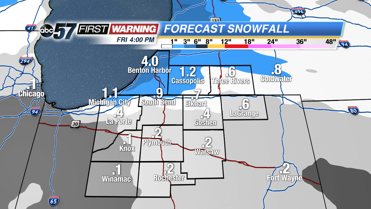 Only minor snowfall through Friday, mostly off Lake Michigan.
Thursday: Partly cloudy, chance of snow late, high of 12.
Friday: Light snow showers, high of 18.
Saturday: Light show showers, highs in the mid-teens.