Big boundary keeps Michiana cool and rainy
Posted: May 10, 2018 4:45 PM EDT

-
4:24

Michiana Crime Stoppers shredding event
-
1:16

’IvyCares’ program setting students up for success in and...
-
1:45

Windy and wet this weekend, but unseasonable warmth as well
-
3:13

Local players react to $3 million investment in Byer Softball...
-
0:32

Layoffs at Whirlpool could affect workers in Benton Harbor
-
1:03

Annual District Sisterhood Conference at Ivy Tech empowers students
-
1:49

Back home in downtown South Bend, YMCA to open new location
-
2:16

This week’s ABC57 Cub Reporter is Nicholas Zentz
-
3:05

Amazon Web Services invests $11 billion to build data center...
-
4:05

Riley High School student center stage at the NFL Draft
-
1:35

Rain, wind, and milder temperatures forecast this weekend
-
2:49

Joe Alt expected to be drafted in the first round of NFL Draft

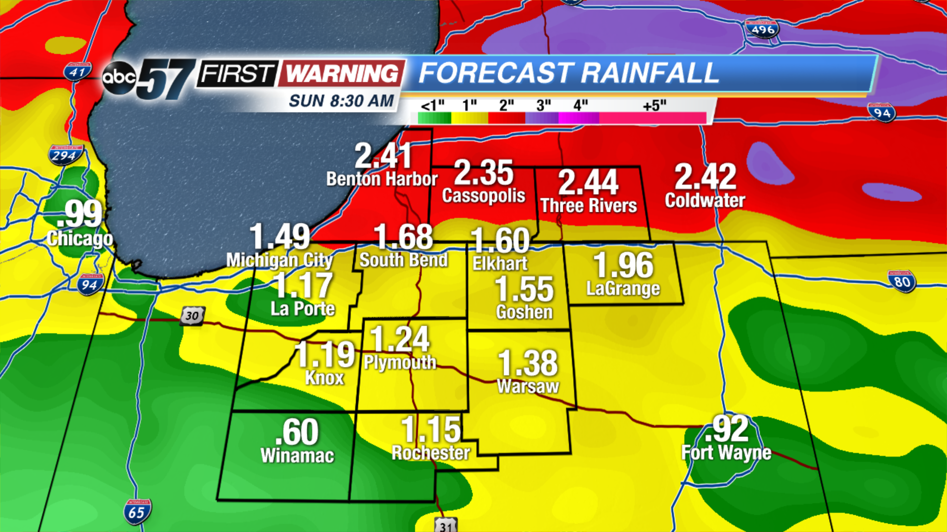
A stationary front will cut a sharp divide in temperatures across North Central Indiana. Most of Michiana will stay in the cool sector, meaning highs in the 50s and 60s but 70s and 80s will loom just to our south. Along that stalled boundary will form rounds of showers and thunderstorms that last through Saturday. These near stagnant systems can lead to excessive rainfall and flooding, more than two inches of rain could fall in the next 48 to 72 hours, minor flooding is possible.
Tonight: Mostly cloudy, chance of showers late, low of 46.
Friday: Mostly cloudy, chance of showers and storms, high of 62.
Saturday: Scattered thunderstorms, high of 62.
Sunday: Becoming partly cloudy, high of 70.
Sign up for the ABC 57Newsletter