ABC57 First Warning Neighborhood Weather Forecast
Monday, November 16th, 2020
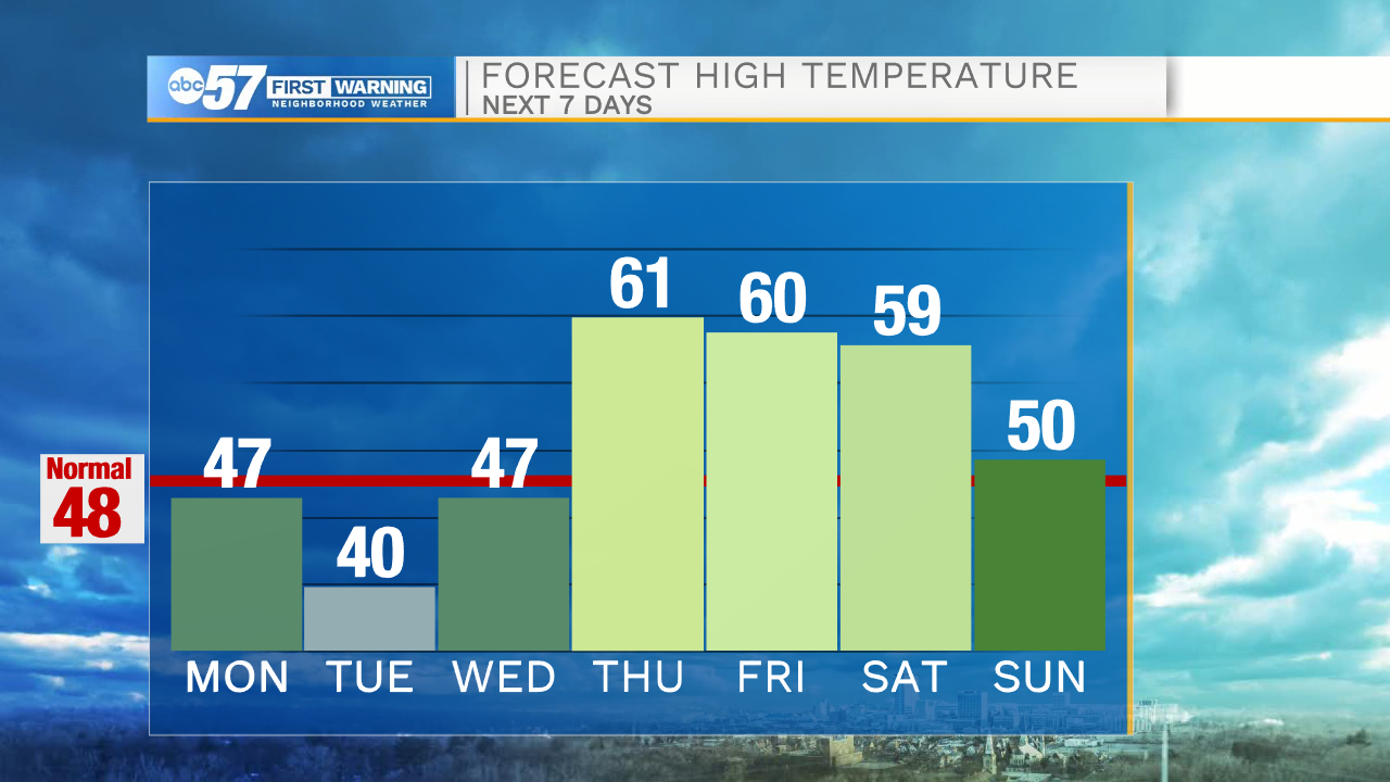
Clouds continue to clear this morning but they may hang on a little longer for our Michigan counties. A few more lake effect clouds are possible tonight along with lake effect mix/snow showers into Tuesday morning. The winds out of the NW keep Tuesday chilly as well, only warming to 40 degrees. It starts to warm back up for Wednesday with plenty of sunshine. Thursday is even nicer as we top out in the low 60s!
Daytime highs remain near 60 degrees through Saturday but clouds move in for the weekend. Rain returns Friday night with a chance of rain on Saturday. Sunday looks mostly likely to have rain as a strong low pressure system moves through.
Today: Clearing skies. High 32.
Tonight: Mostly clear. Low 40.
Tuesday: Morning lake effect possible, partly cloudy. High 40.
Wednesday: Mostly sunny. High 47.