
-
1:40

Justin Allgaier looks to reclaim Indianapolis victory as NASCAR...
-
1:38

Nascar driver Alex Bowman announces retirement following the...
-
0:51

South Bend celebrates graduation of 16 new firemen
-
1:05

Corewell Health unveiling a new urgent care center in Royalton...
-
3:06

2026 WNBA All Star game features 5 former Irish standouts
-
3:04

South Bend International Airport officials detail renovations,...
-
1:39

Storms returns Sunday night through Monday
-
3:18

Addressing unknowns as cyclospora parasite sickens many Americans
-
0:51

Heat and humidity spike this weekend
-
1:04

Fair Weather Friday
-
2:53

Notre Dame staff fill Four Winds Field for sold-out South Bend...
-
2:15

Granger Christian School is closing doors after 55 years.

Cool, cloudy and dreary describes the midweek. High temperatures will be running 10 to 15 degrees below normal, struggling to break the mid-60s. The difference in lake and air temps will produce lake effect clouds and rain bans. The northwesterly pattern finally ends Friday, milder and sunny weather returns for the weekend.
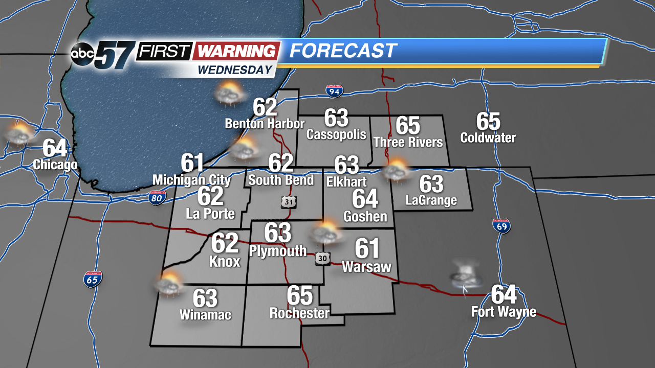 Highs struggle to mid the mid 60s Wednesday
Tonight: Partly to mostly cloudy, showers by morning, low 48.
Wednesday: Mostly cloudy, lake effect rain showers, high of 62.
Thursday: Partly cloudy, lake effect rain showers, highs of 64.
Friday: Mostly sunny, highs in the low 70s.
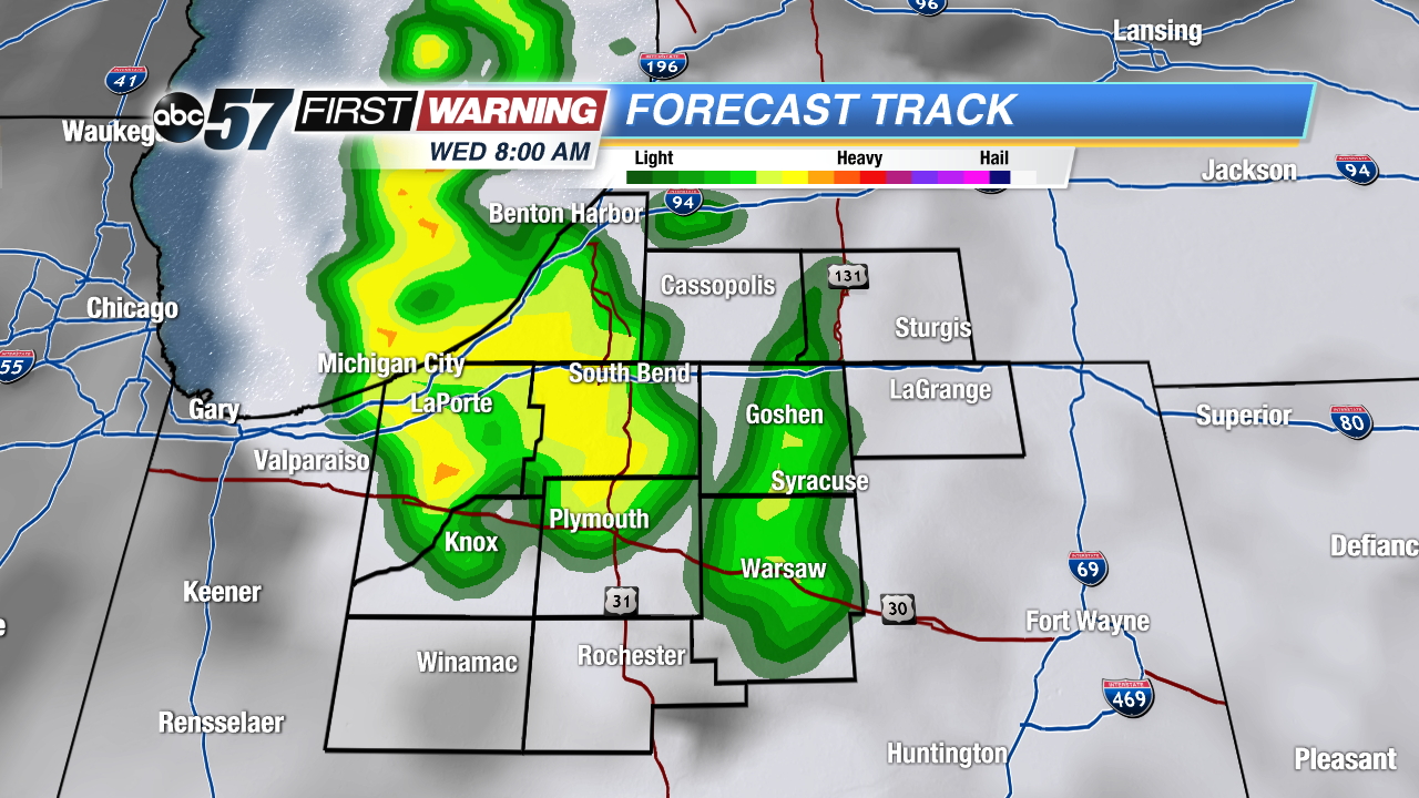 Lake effect rain bands start Wednesday morning
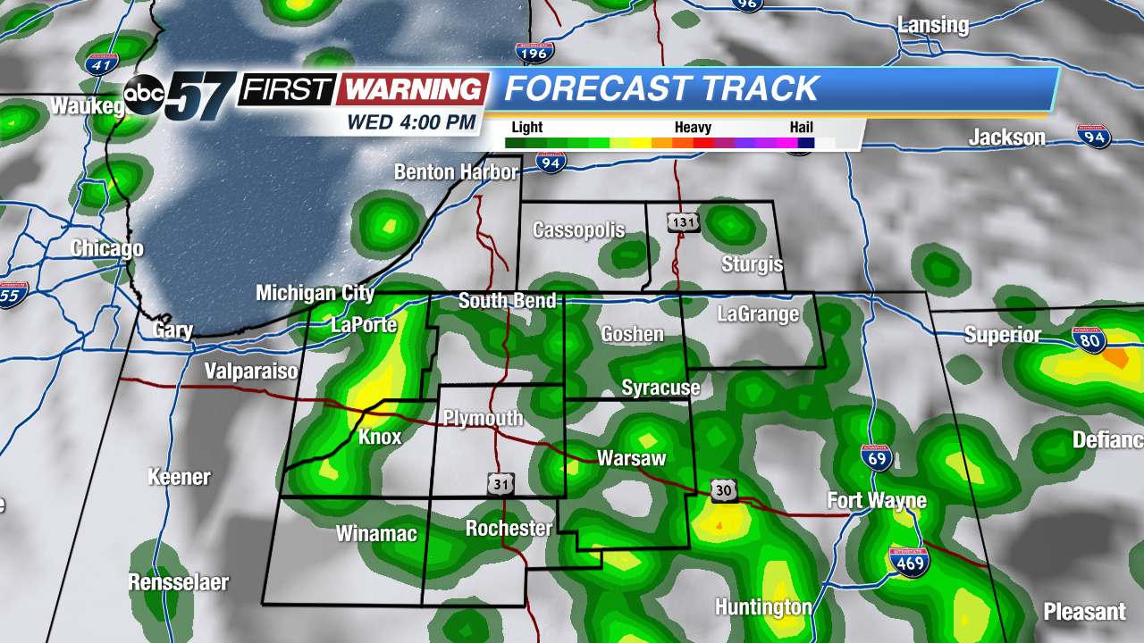 Lake effect showers continue but highly scattered through Wednesday
Sign up for the ABC 57 Newsletter