
Falling temperatures Wednesday, Lake effect Thursday
By:
Tom Coomes
Posted: Jan 18, 2022 5:57 PM EDT

-
1:59

Kosciusko County Fair opens 109th year with parade, new alcohol...
-
2:00

Music enthusiasts gathered for the inaugural South Bend Record...
-
5:22

Coaches vs. Cancer raises money for American Cancer Society
-
0:57

Heat knocking on our door
-
0:54

Pleasant weekend continues
-
1:31

Longtime South Carolina Senator Lindsey Graham dead at 71
-
1:01

Summery Sunday
-
1:55

Bristol Homecoming Festival brings another year of family fun
-
0:55

Concours d’Elegance celebrates its 8th annual two-day event
-
0:57

Fairly average summer weekend
-
0:54

Mild morning setting up beautiful weekend
-
2:29

Kevin Ward Meyers was a man with a lengthy criminal record

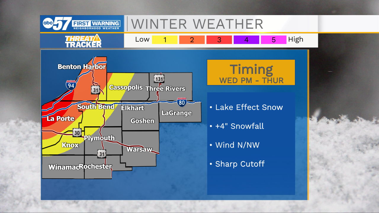
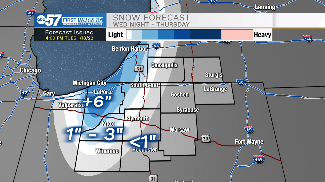
Falling temperatures Tuesday, from near 40 before sunrise to the teens by sunset. The cold blast will turn on the lake effect snow machine Wednesday night. The likely single band that develops will bring heavy snow, low visibility and hazardous travel to a very localized area. The I-94 corridor especially in Berrien and LaPorte Co will be impacted, with more than six inches of snow possible. That snow cuts-off sharply away from the lake. Beyond lake effect snow Thursday, the forecast is cold and quiet until a clipper system Monday.
Tonight: Mostly cloudy, breezy. Low 38.
Wednesday: Temperatures fall from 32. Lake effect snow by the evening.
Thursday: Lake effect snow showers. High 20.
Friday: Mostly sunny. High 22.
Sign up for the ABC 57 Newsletter