

-
2:20

Storms could be trending later
-
2:35

Ice Box skating rink boot camp teaching hockey and life skills...
-
2:05

The Ship and Shore Blues and Soul Festival relaunches the decades...
-
1:32

Round two brings flood potential tonight
-
1:46

Round One of storms arriving soon
-
1:40

Strong winds and heavy rain likely for Michiana
-
1:51

Tracking multiple rounds of strong storms Sunday
-
2:28

Aftermath of Eddy Street shooting leaves residents unsettled
-
2:16

Be weather aware Sunday and Monday
-
2:08

Zimmy’s benefit fundraiser draws a large crowd at the Cass...
-
3:08

Notre Dame secondary taking shape as Irish embrace ‘5 to 6...
-
0:51

Take a Seat auction raises funds for art in downtown Niles

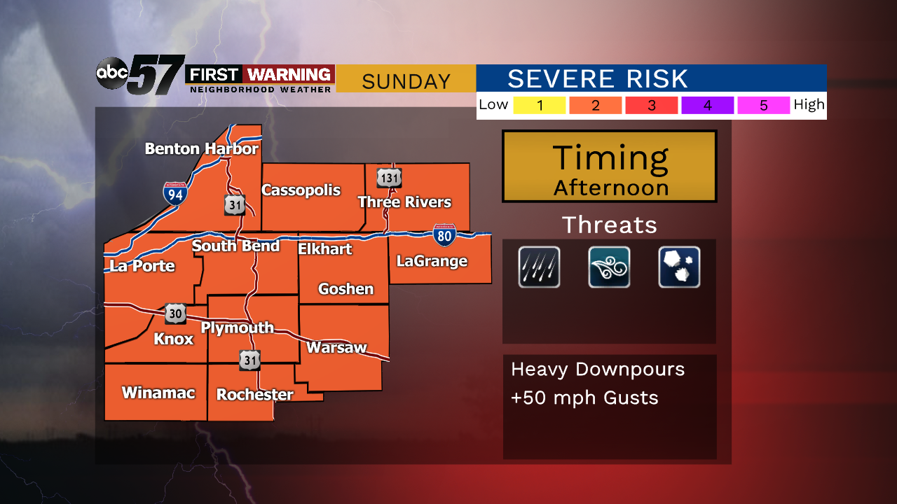
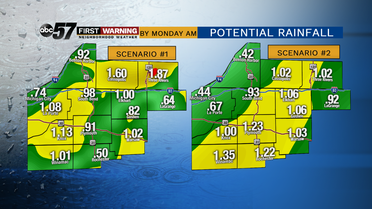
Saturday will be the warmest day of 2019, to date. Temperatures start in the 50s but surge into the mid-80s by the afternoon, cloud will build but the rain threat remains lows until Sunday. Sunday will see scattered showers and thunderstorms and if there is a break of sunshine a severe threat in the afternoon /evening. Temperatures cool again to start next week, Monday and Tuesday are back in the 60s.
Tonight: Chance of showers, low of 56.
Saturday: Partly cloudy, high of 84.
Sunday: Scattered showers and storms, high of 74.
Monday: Mostly sunny, high of 62.
Sign up for the ABC 57 Newsletter