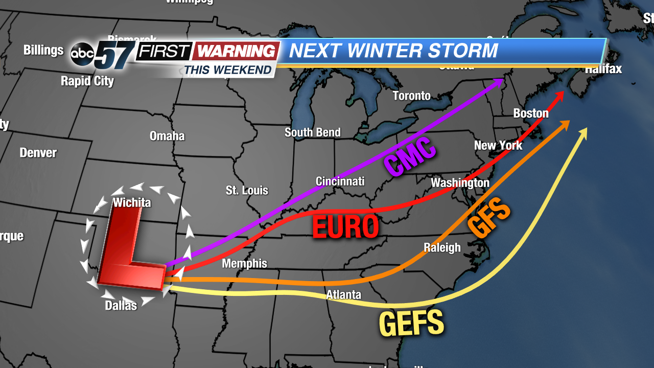
Just a couple of days after a major winter storm slammed parts of the Midwest, Great Lakes, Ohio Valley, and Mid-Atlantic, there's another one on the horizon. An area of low pressure will develop in Oklahoma by Friday morning and move east or northeast depending on which forecast model you look at. Regardless of its exact track, at least some wintry impacts are expected across Indiana and Southern Michigan. Similar to this past weekend's storm, though, early indications are that we
may be on the northern edge of the snow.
It's important that you don't look at any one forecast model and roll with it this early despite probably seeing snowfall forecasts showing two feet of snow circling around on social media. It's still a bit too early to put a significant amount of trust into any model when the storm itself is still in the Pacific Ocean south of Alaska. Being 4-5 days out, what we
can look for are trends and general ideas in the models. And, as of Monday morning, the trends and ideas suggest a significant winter storm
somewhere in the Midwest, Great Lakes and Ohio Valley come this weekend.
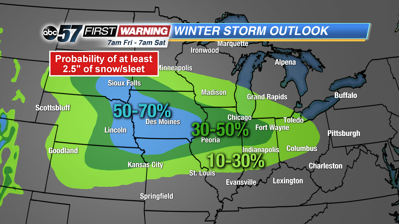 Probability of at least 2.5
Probability of at least 2.5
Probability of at least 2.5
As of now, the winter threat zone does include Michiana, but areas with the highest chance of seeing significant impacts extend from Missouri and Central Illinois to much of Indiana, Ohio and Pennsylvania. Again, this is just based off the latest trends and ideas in the models. The Weather Prediction Center currently gives areas along and south of the Toll Road in a 30-50% chance of
at least 2.5" of snow between 7 a.m. Saturday and 7 a.m. Sunday. This will likely change at least somewhat over the coming days as the system gets closer.
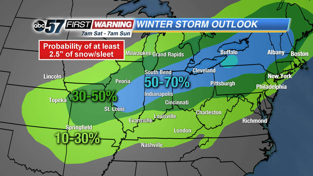 Probability of at least 2.5
Probability of at least 2.5
Probability of at least 2.5
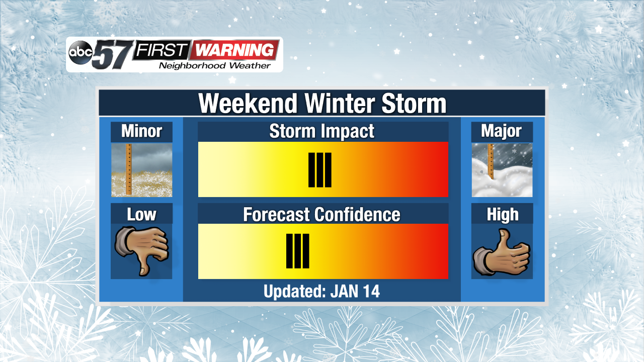
It's certainly a storm that deserves attention and bears watching. For now, just be aware that snow is in the forecast in Michiana on Saturday, and accumulation is very possible. It also looks like there will be some breezy winds as the system passes by to our south. Confidence is quite low regarding snow totals, where the heaviest snow will fall and overall impacts to travel. That will grow throughout the week, so be sure to stick with the ABC 57 First Warning Neighborhood Weather Team.