
-
0:48

VFW celebrates love with Valentine’s Day brunch
-
1:51

Warming trend continues through next week
-
4:31

Fighting Irish hunt for a win against the wolfpack
-
3:49

Celebrating 50 years of women’s athletics
-
5:58

Irish face a must-win scenario
-
4:06

Friendly game of P.I.G. with Cole Certa
-
2:30

Lovely conditions for your Valentine’s Day
-
2:47

Michiana gets together for Galentine’s Day
-
1:15

Two paramedics honored with the hero award for their life saving...
-
2:12

Elkhart residents express outrage following the arrest of local...
-
2:14

Notre Dame fighting for ACC tournament position ahead of matchup...
-
1:47

Kindergarteners showing appreciation for educators this Valentine’s...

Messy winter weather to end the week. Widespread system snow starts early Friday morning. The first flakes are likely to melt due to the warm ground and air temperature just above freezing. Grassy areas are likely the first to accumulate but most of Friday is wet / slushy.
Cold air surges across the lake Friday night, after midnight accumulation of more than three inches is possible across southwest Michigan, less than three inches near the state line. Snow ends Saturday morning, the rest of the day will be bitterly cold for November.
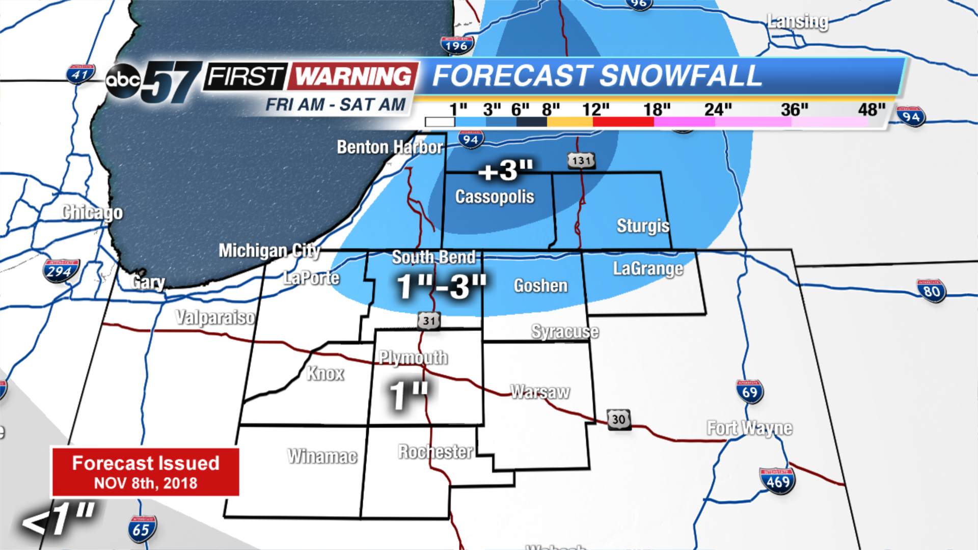
Tonight: Early AM snow/mix, low of 32.
Friday: Mix/snow showers then lake effect snow, high of 38.
Saturday: Morning lake effect snow, high of 34.
Sunday: Mostly cloudy, high of 38.
Sign up for the ABC 57 Newsletter