
-
1:21

How firefighters keep cool in the summer heat
-
1:04

Local Elkhart business hosts Humanitarian Drive for Venezuela
-
3:22

Michigan City officials address privacy concerns as police consider...
-
2:11

Community reviews 62 recommendations by the South Bend Reparatory...
-
4:00

Mishawaka Police Department provides new details on police confrontation...
-
1:35

Vandals hit four mausoleums at Crystal Springs Cemetery
-
0:54

The Extreme Heat starts today
-
4:22

From train tracks to highways, how Indiana became the “Crossroads...
-
0:45

The heat starts now
-
1:15

Showers and storms possible for the holiday weekend
-
2:46

Buchanan celebrates unity during fourth annual Pride event
-
1:53

Mishawaka celebrates America’s 250 with music

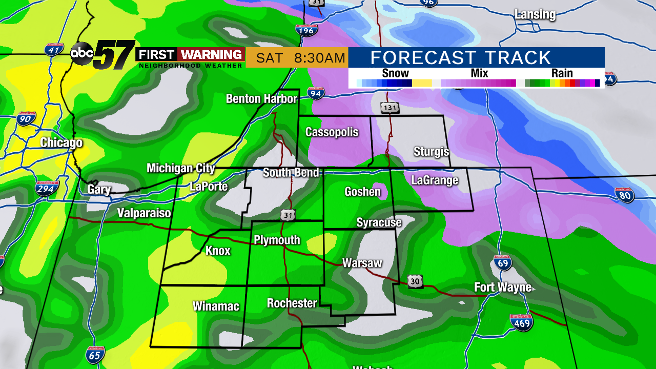
Staying cloudy but dry through Friday, temperatures warm slowly into the low 40s. Our next fall storm arrives early Saturday and may start with rain/sleet, then changing to all rain. The weekend is mostly wet and breezy with a rain/snow mix possible by Sunday afternoon. The first week of December is pretty mundane, mostly cloudy and highs near 40.
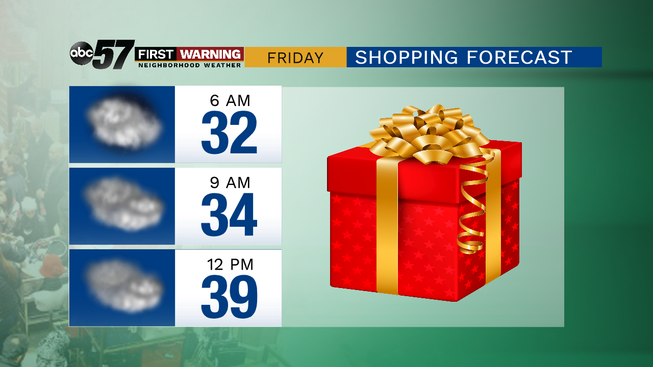
Tonight: Cloudy. Low of 32.
Friday: Cloudy. High of 42.
Saturday: Wintry mix early, rainy, slow warm-up to 42 just before midnight.
Sunday: Temperatures falling from the mid-40s early, midday and PM rain/snow showers.
Monday: Mostly cloudy. High of 40.
Sign up for the ABC 57 Newsletter