

-
1:59

Kosciusko County Fair opens 109th year with parade, new alcohol...
-
2:00

Music enthusiasts gathered for the inaugural South Bend Record...
-
5:22

Coaches vs. Cancer raises money for American Cancer Society
-
0:57

Heat knocking on our door
-
0:54

Pleasant weekend continues
-
1:31

Longtime South Carolina Senator Lindsey Graham dead at 71
-
1:01

Summery Sunday
-
1:55

Bristol Homecoming Festival brings another year of family fun
-
0:55

Concours d’Elegance celebrates its 8th annual two-day event
-
0:57

Fairly average summer weekend
-
0:54

Mild morning setting up beautiful weekend
-
2:29

Kevin Ward Meyers was a man with a lengthy criminal record

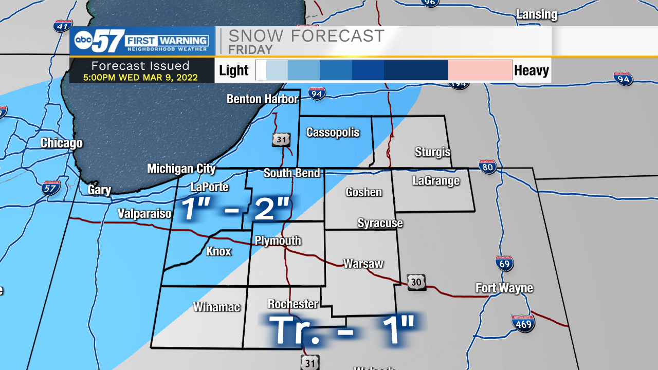
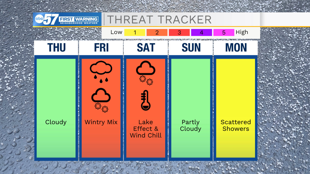
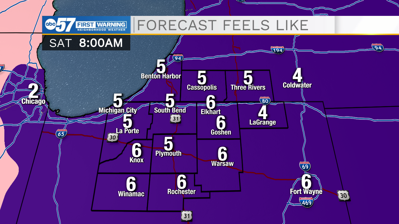
Temperatures fall into the weekend. Thursdays is chilly and cloudy, but still the calm before the storm. Friday second cold front will bring wet snow showers, with light accumulation Friday morning. Temperatures fall sharply into Friday, highs in the 20s but wind gusts topping 40 mph, will make for a wind chill near zero. To top it all off, lake effect snow could bring a couple inches of additional snowfall to the snowbelt. The wintry weather won't last, as temperatures rise near 50 Sunday, with sunshine.
Reminder: Daylight Saving Time begins at 2:00 a.m. on Sunday, March 13. We spring forward one hour.
Tonight: Mostly cloudy. Low 26.
Thursday: Mostly cloudy. High 40.
Friday: Wet snow showers. High 36.
Saturday: Cold and windy, lake effect snow showers. High 26.