

-
2:45

Answering sun protection questions
-
1:47

Hot and smoky today
-
2:07

Locals have big visions for new skatepark in St. Joseph
-
2:29

Elkhart County residents still waiting for repair help a month...
-
2:58

Disability parking placards now available for autism caregivers
-
1:13

Sinkhole develops on the Southwest side of South Bend
-
3:13

Local restaurants taking extra precautions to try and keep Cyclosporiasis...
-
3:39

World Series of Baton Twirling returns to Notre Dame, bringing...
-
2:37

Historic State Theater project awarded millions of dollars towards...
-
2:05

Building Nicholas Stanley’s defense in the final weeks before...
-
2:03

Fatal June officer-involved shooting of Jujuan Bates deemed justified,...
-
1:15

IDEM forecasts Air Quality Action Day for Northern Indiana due...

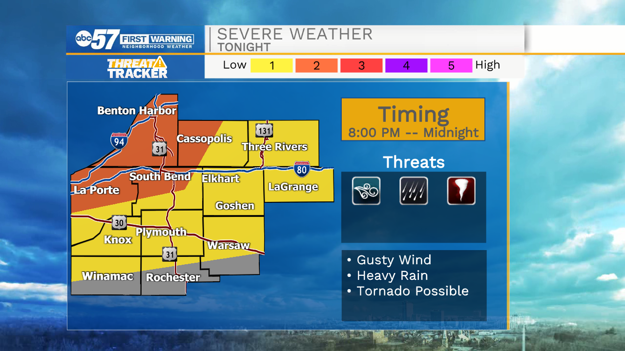
This Evening: A complex / line of storms could bring gusty wind, heavy rain and flooding to the area late this evening around 10:00 PM.
Extreme heat and humidity last through the weekend. Wednesday could be the hottest day this week with a heat index as high as 105 degrees. There is a slightly higher chance of storms developing Wednesday afternoon and evening as well. Overall the storm threat remains mostly scattered to isolated, depending on formation each afternoon. The heat and humidity finally fade by Monday.
Tonight: Isolated thunderstorms. Low 74.
Wednesday: Hot and humid. Scattered thunderstorms. High 93.
Tuesday: Hot and humid. Isolated PM thunderstorms. High 90.
Wednesday: Hot and humid. Scattered thunderstorms. High 90.
Sign up for the ABC 57 Newsletter