
-
0:57

Scattered storms through early morning
-
2:13

Microsoft to partner with Ivy Tech in La Porte to launch Data...
-
2:41

Notre Dame’s Coaches vs. Cancer fundraiser aims to build on...
-
2:28

St. Joseph County Leaders Begin 2027 Budget Process
-
1:59

Michigan Community to vote on a Milage renewal on August 4 Primary
-
1:18

Will wildfire smoke reduce the mosquito population?
-
0:59

LaGrange County lawmakers approve One-year data center moratorium
-
3:11

Indiana developer faces federal lawsuit after allegedly misusing...
-
1:44

Overnight storms clear smoke
-
1:02

Lingering smoke out the door
-
2:30

Storms return Monday overnight into Tuesday
-
1:46

Leadership, discipline and responsibility: 4-H leads the way...

Now through Friday evening will be a high impact lake effect snow event. Persistent snowfall will bring at least three to six inches per day in the lake effect zones, including South Bend and Elkhart. Higher amounts of 12 to 18 inches in southwest Michigan. Whiteout conditions are possible when crossing intense squalls. Use extreme caution when traveling the next two days.
There is a break from the snow Saturday, before a system warms the area into the 30s but brings additional snowfall Sunday and Monday.
Tonight: Lake effect snow showers, low of 8. 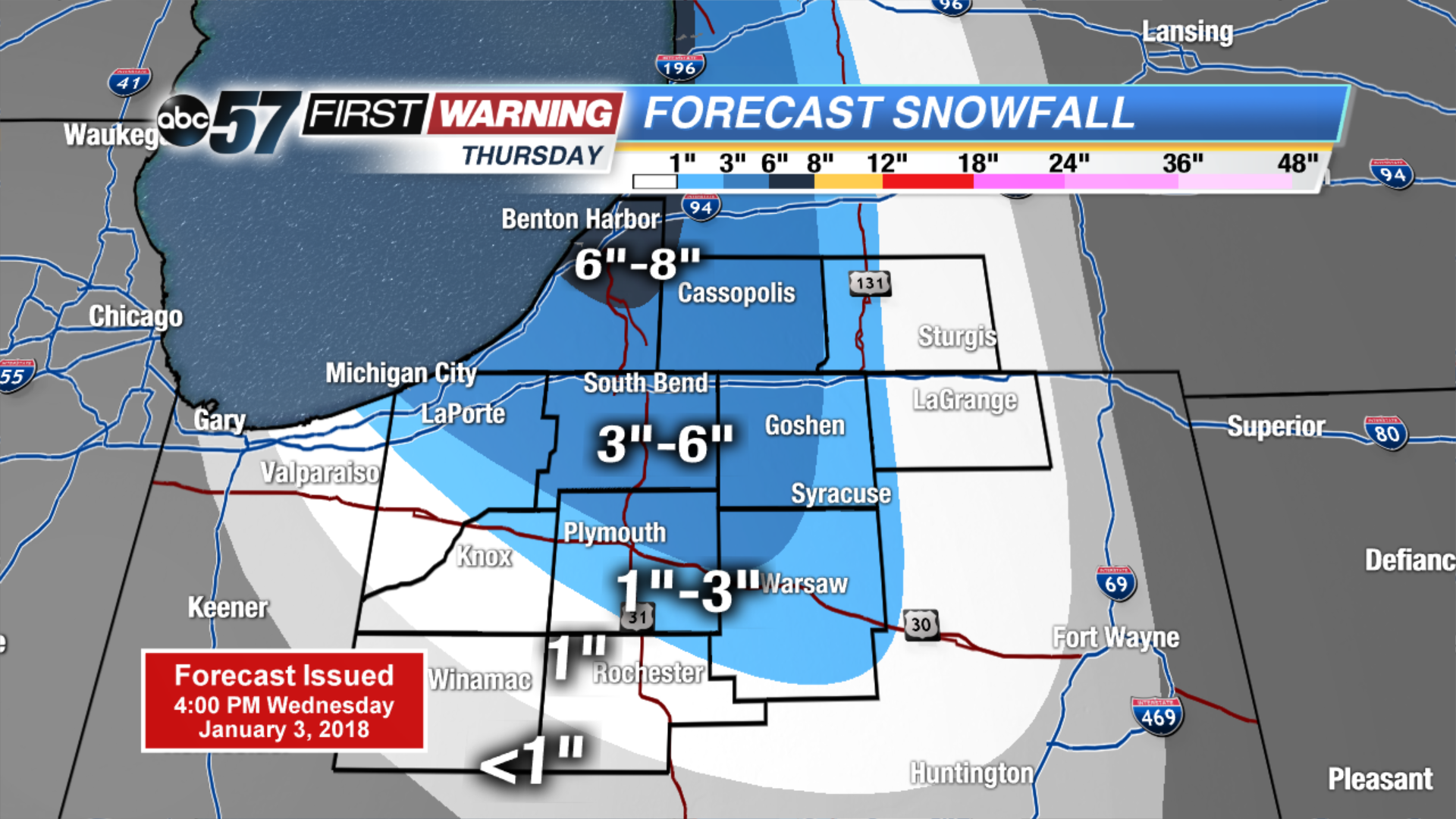 Thursday ONLY snowfall
Thursday: Lake effect snow showers, high of 12.b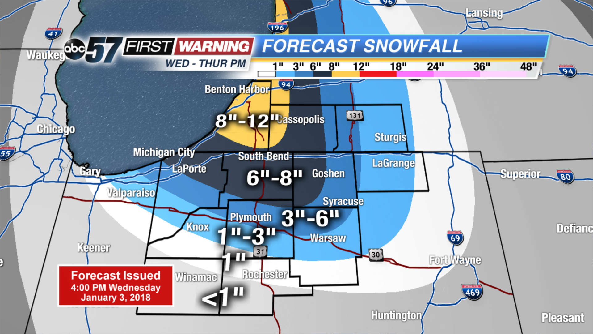 Estimated two day totals
Friday: Lake effect snow showers, high of 10.
Saturday: Partly cloudy, high of 15. ![]() High impact lake effect snow event.
High impact lake effect snow event.
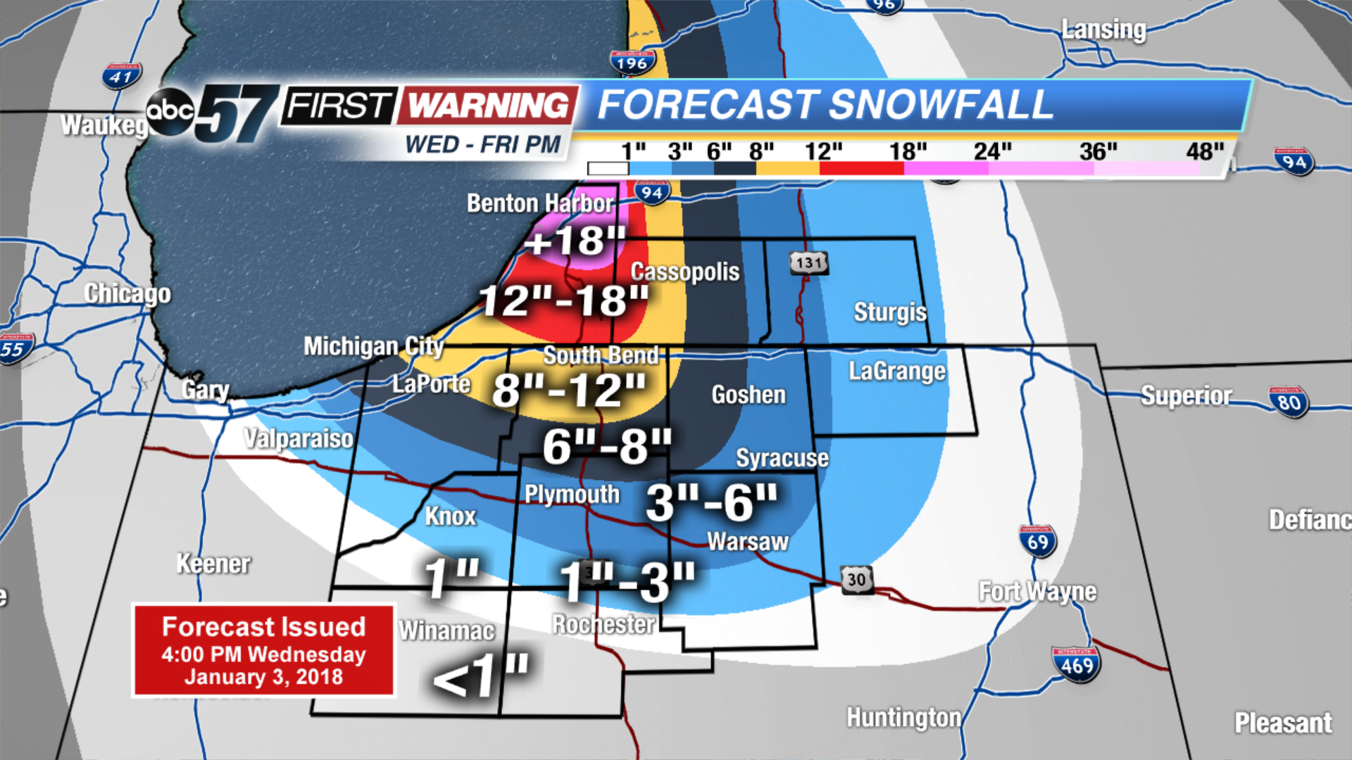 Estimated three day totals