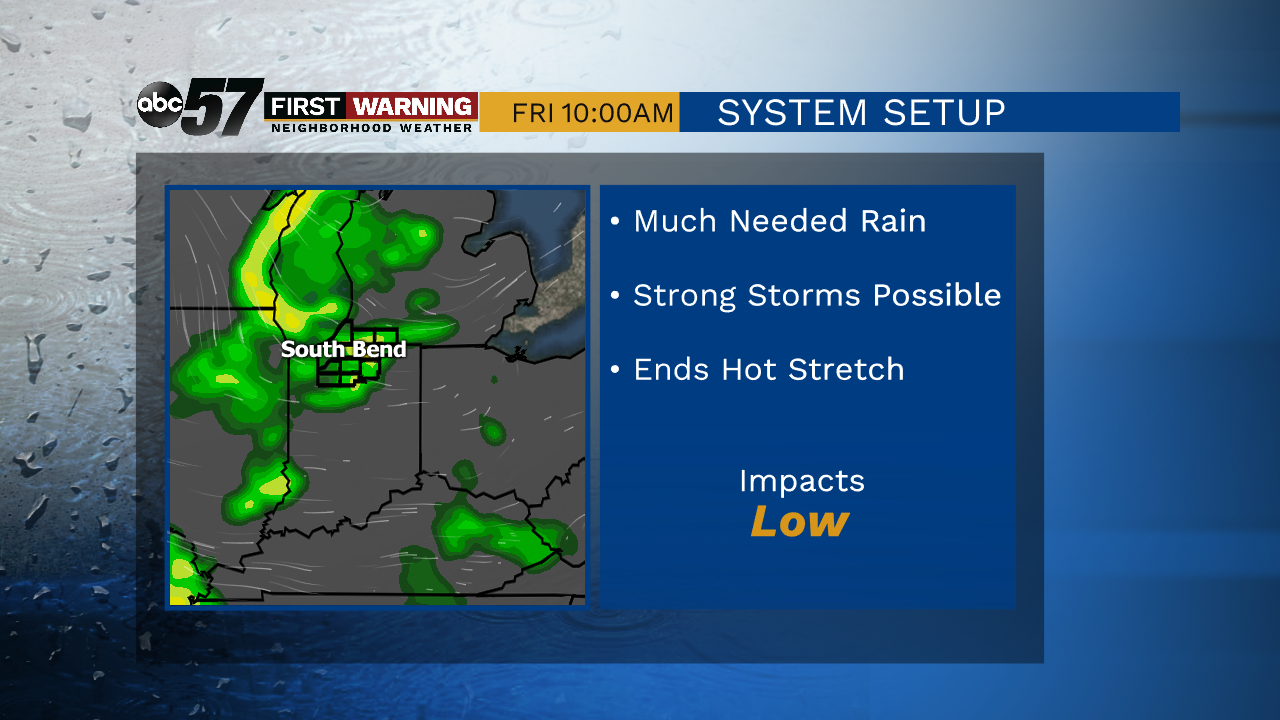
Hot and humid but late week storms bring relief from the heat



ABC57 First Warning Neighborhood Weather
Tuesday, July 7th, 2020
The hot July weather continues through this week! Daytime highs will top out in the low to mid 90s with humidity building in on Wednesday. The heat index could reach near the upper 90s for some on Thursday.
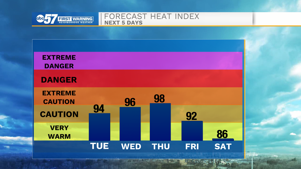
A stray shower or storm could be seen this afternoon/evening but we need a good widespread rain as we’ve been so dry. Isolated showers and storms are possible Thursday evening but widespread storms look more likely Friday. That system will finally cut down on the heat! Daytime highs cool to the mid-80s over the weekend.
Today: Mostly sunny and hot. PM stray shower/storm. High 93.
Tonight: Mostly clear. Low 71.
Wednesday: Mostly sunny, hot and humid. High 94.
Thursday: Mostly sunny, hot and humid. Isolated evening storms. High 94.