-
1:14

Mostly dry with a stray shower possible, Better storm chances...
-
2:42

Local mother calls on community to help find family keepsakes...
-
2:35

Police say social media posts about ICE in Benton Twp. are false
-
0:56

Mayor Mueller vetoes Bill No. 26-21 on trail proposal
-
2:09

Bentley Warren Classic connects NASCAR legends with future stars
-
2:42

Bristol council accepts Innovation Park withdrawal
-
1:33

Strong storms possible Sunday through Tuesday
-
2:06

Leonard Moore shines as Notre Dame defense opens fall camp ahead...
-
2:27

Offensive position battles heat up as Notre Dame opens fall camp
-
1:05

Potawatomi Zoo brings back Branch to Browse program
-
1:45

Berrien Community Foundation gearing up for the school year
-
1:18

Showers taper off this evening, Spotty storms this weekend

ABC57 First Warning Neighborhood Weather Forecast
Monday, July 5th, 2021
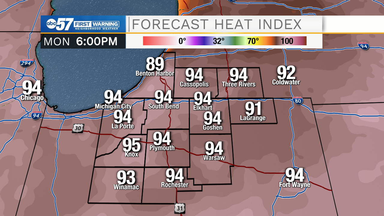
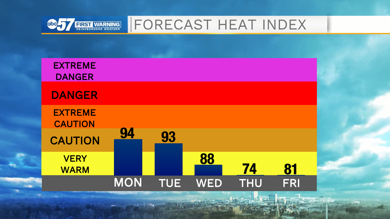
It's another hot and humid day. As many people are still out and about, celebrating the extended 4th of July holiday weekend, you'll need to drink plenty of water and take breaks from the heat. The heat and humidity continue on Tuesday with a stray shower or storm possible. We'll get a break from heat after a cold front moves through Wednesday evening, bringing a round of showers and storms along with it. The rain will continue into Thursday morning but it brightens up the second half of the day. Another nice day on Friday before the chance of rain increases heading into the weekend.
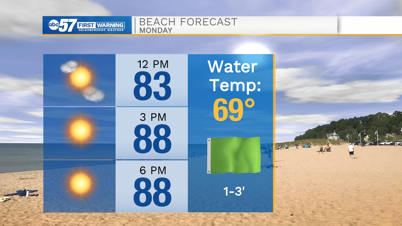
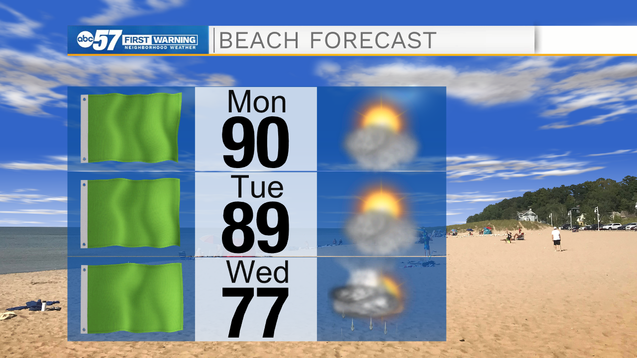
Today: Sunny. Hot and humid. High 92.
Tonight: Mostly clear. Low 70.
Tuesday: Partly sunny. High 90.
Wednesday: PM thunderstorms. High 86.