Hot and humid Thursday, storms Friday


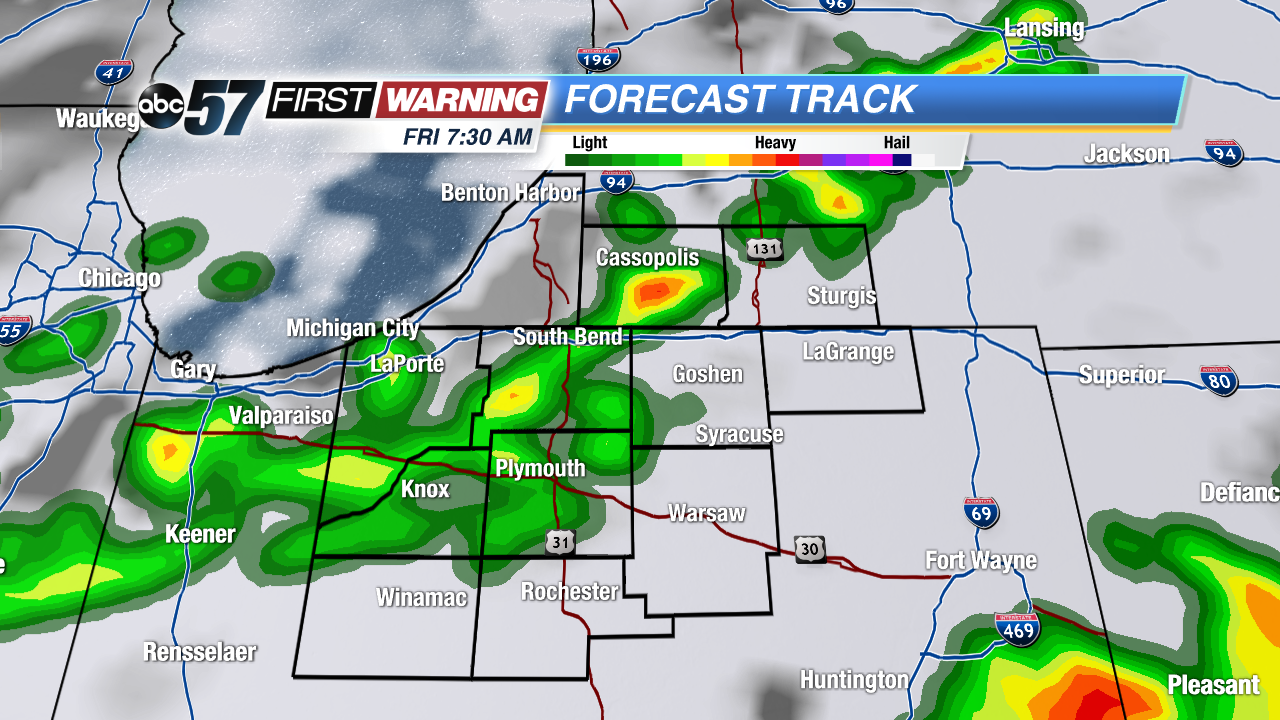 Models have been consistent with widespread rain/storms early Friday, this would reduce the severe threat.
Heat and especially the humidity rise quickly Thursday, the only hot and humid day in the forecast. High will near 90 and there’s a chance for pop-up showers and storms, but most will stay dry during the day. The chance of rain increases overnight Thursday, into early Friday ahead of an advancing cold front. Widespread storms are most likely Friday morning, severe weather is possible but the early morning timing diminishes that threat. The weekend looks mild and mostly dry.
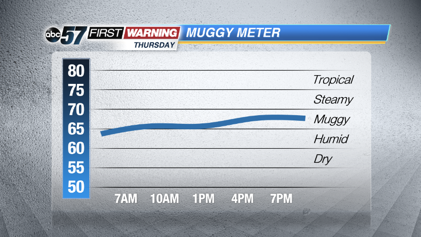 Dewpoints will near 70, the start of the steamy category
Tonight: Mostly clear to partly cloudy, low of 68.
Thursday: Partly cloudy, a chance of storms, high 88.
Friday: Morning showers and storms, high 78.
Saturday: Mostly sunny, highs in the mid-70s.![]() Part of the area is under the 2/5 moderate severe threat category Thursday night - Friday morning
Part of the area is under the 2/5 moderate severe threat category Thursday night - Friday morning