
Hot through Tuesday, storms arrive Tuesday after midday
By: Emily Kennedy
Posted: Sep 13, 2021 3:07 AM EDT

-
0:57

Heat knocking on our door
-
0:54

Pleasant weekend continues
-
1:01

Summery Sunday
-
1:55

Bristol Homecoming Festival brings another year of family fun
-
0:57

Fairly average summer weekend
-
0:54

Mild morning setting up beautiful weekend
-
2:29

Kevin Ward Meyers was a man with a lengthy criminal record
-
1:02

Majestic Care of Goshen holds charity garage sale, with proceeds...
-
0:56

Elkhart School Board discusses transferring Osolo Elementary...
-
1:10

Detroit Pistons Youth Academy basketball camp wraps up Friday...
-
9:25

ABC57 breaks down what led to the shooting of an ISP trooper...
-
2:58

Backup diesel generators at AWS Data Center Campuses in New...

ABC57 First Warning Neighborhood Weather Forecast
Monday, September 13th, 2021
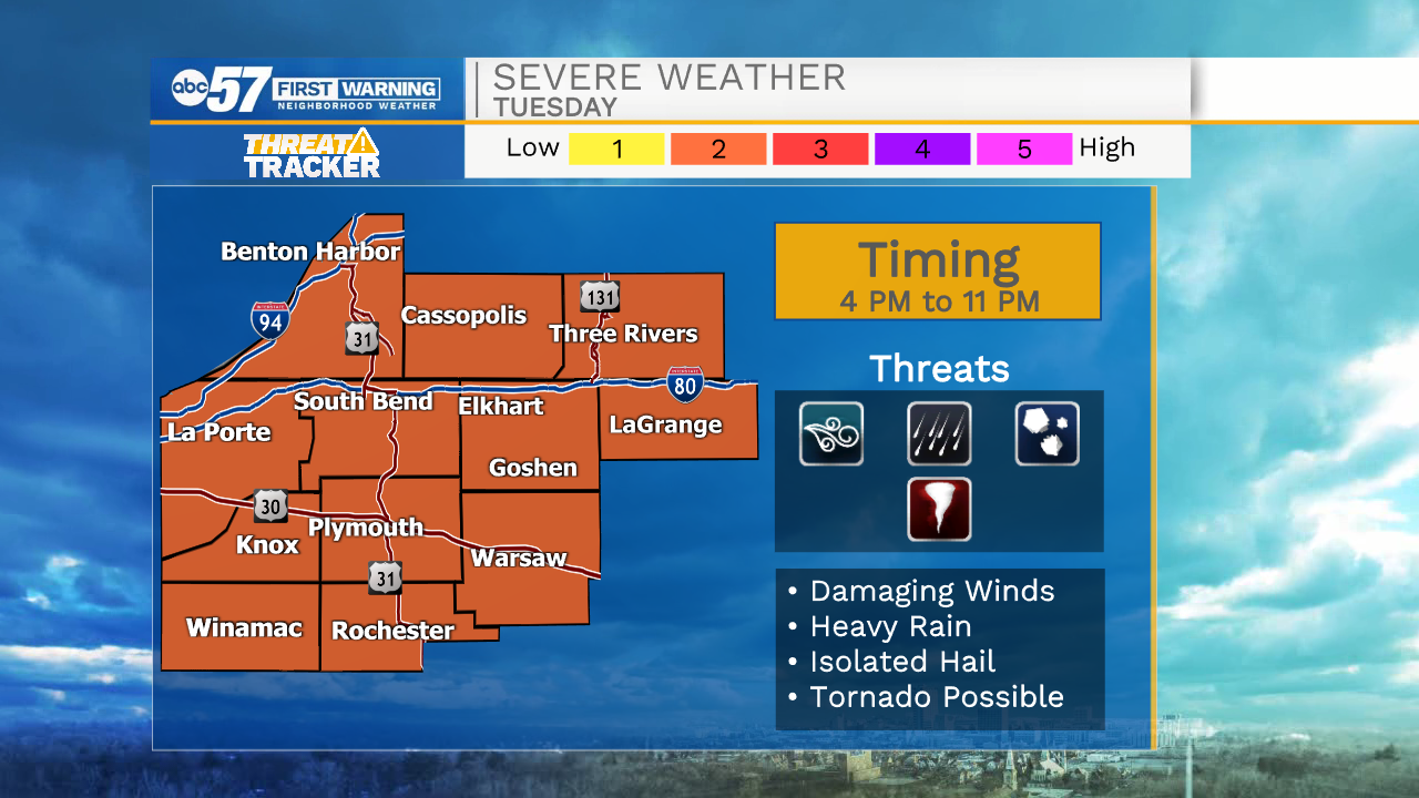
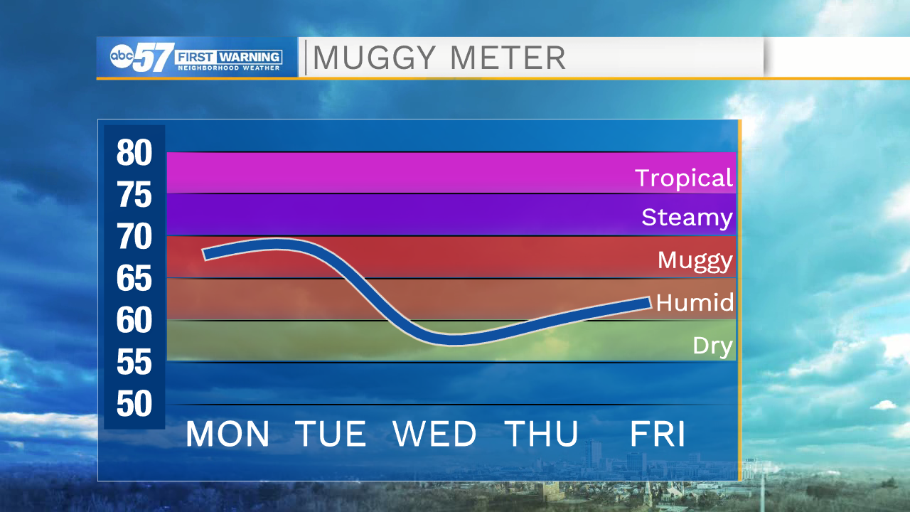
We hold onto this stretch of heat through Tuesday as daytime highs stay near 90s. A round of storms moves in Tuesday evening, ahead of a cold front. These storms could be strong to severe with gusty wind and heavy rain. The rain will linger into Wednesday morning. Temperatures cool into the upper 70s to low 80s for the remainder of the week with sunshine.
Today: AM Clouds, PM Sun. High 88.
Tonight: Partly cloudy. Low 70.
Tuesday: PM Thunderstorms, severe threat. High 90.
Wednesday: AM Showers. High 78.
Sign up for the ABC 57 Newsletter