

-
1:59

Kosciusko County Fair opens 109th year with parade, new alcohol...
-
2:00

Music enthusiasts gathered for the inaugural South Bend Record...
-
5:22

Coaches vs. Cancer raises money for American Cancer Society
-
0:57

Heat knocking on our door
-
0:54

Pleasant weekend continues
-
1:31

Longtime South Carolina Senator Lindsey Graham dead at 71
-
1:01

Summery Sunday
-
1:55

Bristol Homecoming Festival brings another year of family fun
-
0:55

Concours d’Elegance celebrates its 8th annual two-day event
-
0:57

Fairly average summer weekend
-
0:54

Mild morning setting up beautiful weekend
-
2:29

Kevin Ward Meyers was a man with a lengthy criminal record

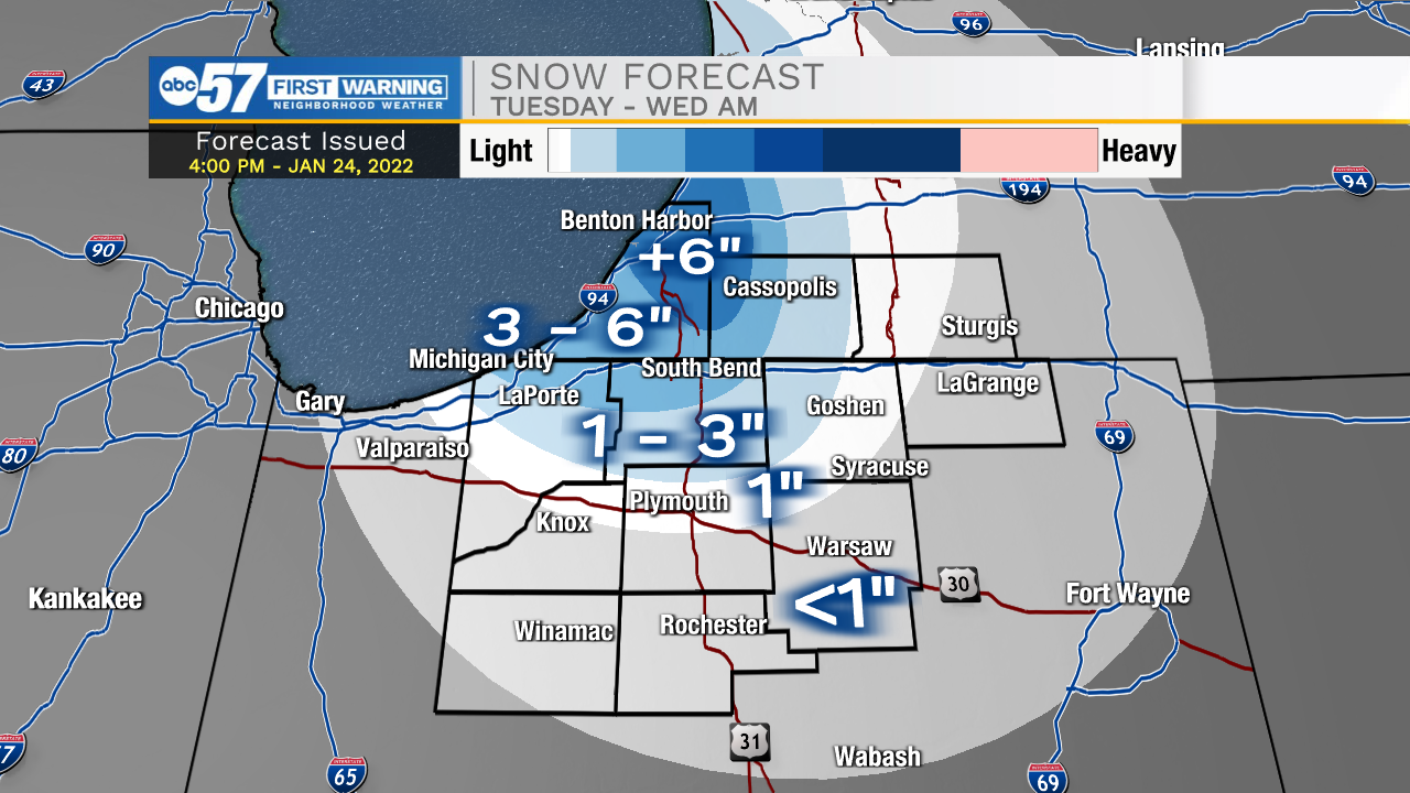
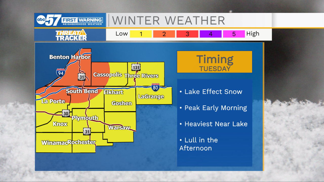
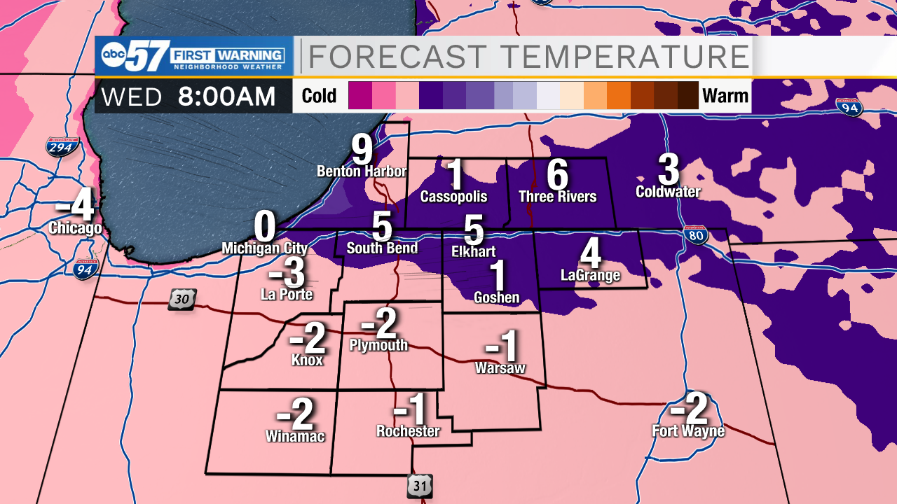
Lake effect snow and bitter cold midweek. Lake effect snow will gradually ramp up-and-down Tuesday. A surge of snow develops in the snow belt early Tuesday morning, then wanes during the day, surging again Tuesday night as temperatures drop again. In total, most the snow belt will see more than three inches of snow, with some in Berrien county getting more than six inches. Wednesday is the coldest day, with temperatures nearing zero at night. The pattern stays cold through the weekend.
Tonight: Lake effect snow. Low 12.
Tuesday: Lake effect snow. High 18.
Wednesday: Partly cloudy and cold. High 12.
Thursday: Evening snow showers. High 30.
Sign up for the ABC 57 Newsletter