



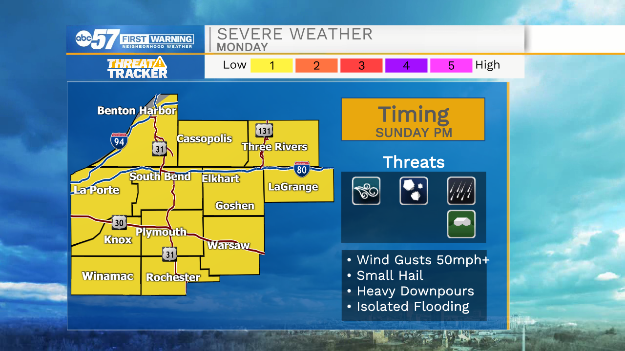
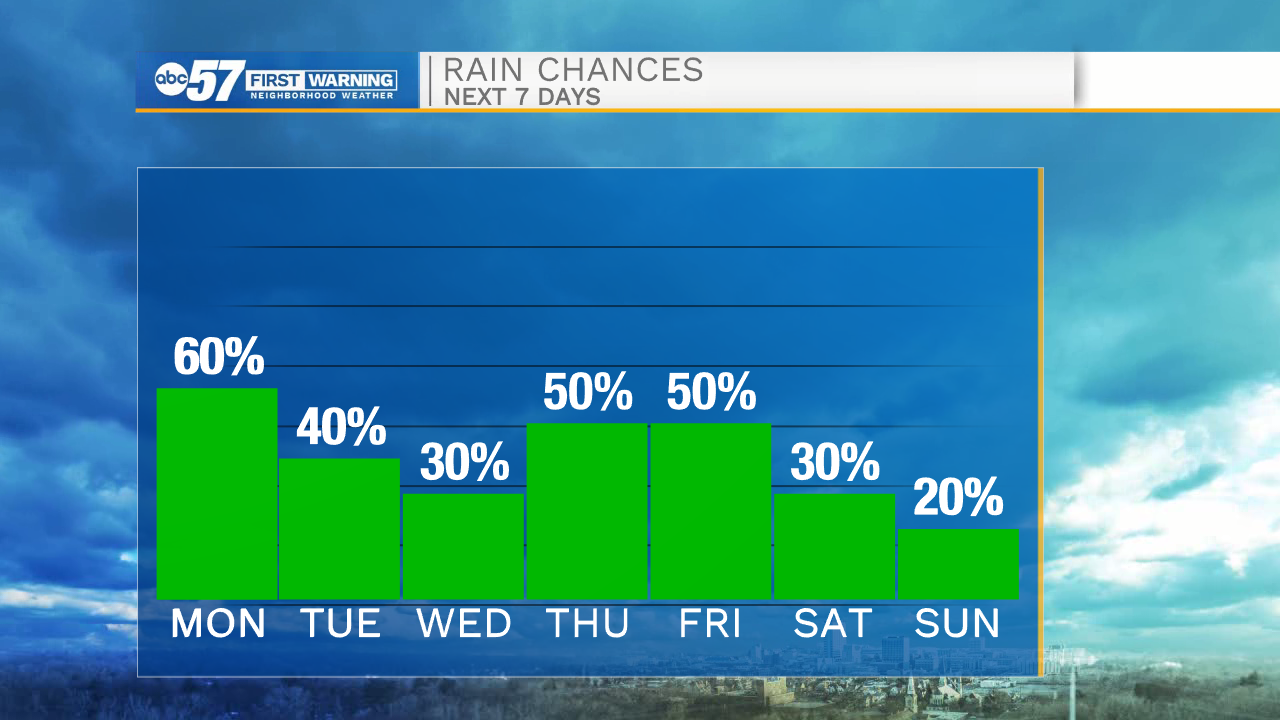
Scattered showers will remain in place throughout portions of Michiana this evening. Overall rain activity will diminish late evening and through the overnight. Light rain and drizzle is possible tomorrow morning, but overall better storm chances hold off until the after and evening. A few storms could be on the stronger side, with the main threat being gusty winds. Any place that deals with thunderstorm activity will likely see a higher flooding potential. Storms will clear out late Monday night. Rinse and repeat the rest of the work week as afternoon thunderstorms and rain showers are possible. Temperatures throughout the week will warm into the mid 80s. Along with the heat, humidity will increase as well. Next weekend, a few isolated showers are possible.
Tonight: Scattered showers. Low 66.
Tomorrow: Afternoon thunderstorms. High 80.
Tuesday: Afternoon thunderstorms. High 82.
Wednesday: Isolated showers. High 86.