More rain tonight but the pattern is trying to dry out
By:
Tom Coomes
Posted: May 29, 2019 4:46 PM EDT

-
1:35

Extreme Heat Watch begins tomorrow
-
0:21

One injured in overnight shooting on South Bend’s northwest...
-
1:11

Pleasant end to the weekend
-
0:48

One person dead after single-vehicle crash in Mishawaka
-
3:37

Local racer hits the pavement at Plymouth Speedway after life-changing...
-
0:58

The beautiful weekend continues tomorrow
-
2:28

Kicking off day two of the Gus Macker Basketball Tournament
-
0:55

Enjoy this weekend
-
0:50

Beautiful weekend starts this morning
-
2:32

Gus Macker Three-on-Three Basketball Tournament is taking over...
-
1:44

Feeling like a sauna next week
-
3:12

How to keep yourself and others protected during firework season

More rain/storms overnight that could bring heavy downpours and the threat of minor flooding and standing water for the morning drive.
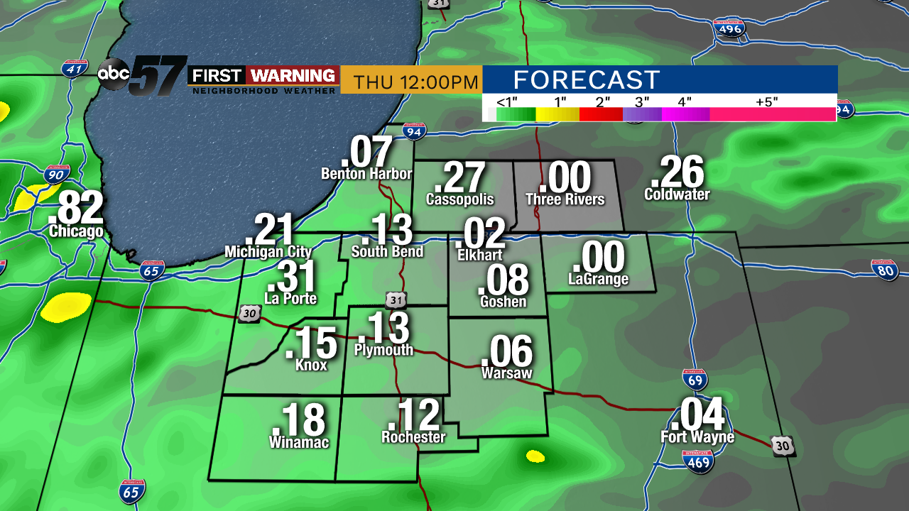
Rain early Thursday, then gradual clearing into Friday. The biggest change in the forecast is a warm-up on Friday as high look to spike near 80 with sunshine. The warm, dry weather doesn’t last as a front crashes through again Saturday with showers and storms. Sunshine returns to end the weekend but temps will be cool for early June with highs in the low 70s.
Tonight: Mostly cloudy with showers/storms overnight. Low of 58.
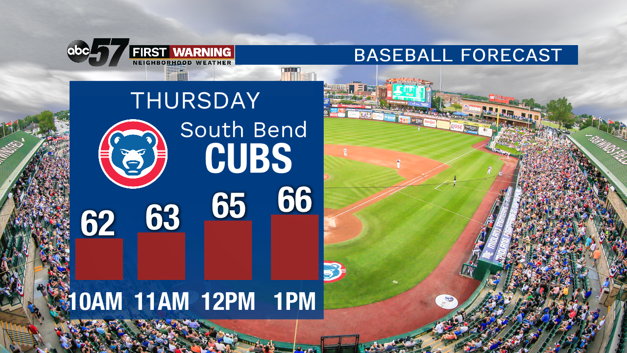
Thursday: Morning showers then clearing, high of 72
Friday: Mostly sunny. High of 70.
Saturday: Scattered showers and thunderstorms by the afternoon. High of 72.
Sign up for the ABC 57 Newsletter