More snow tonight, then sunshine returns
Posted: Mar 13, 2018 4:36 PM EDT

-
3:13

Local players react to $3 million investment in Byer Softball...
-
0:32

Layoffs at Whirlpool could affect workers in Benton Harbor
-
1:03

Annual District Sisterhood Conference at Ivy Tech empowers students
-
1:49

Back home in downtown South Bend, YMCA to open new location
-
2:16

This week’s ABC57 Cub Reporter is Nicholas Zentz
-
3:05

Amazon Web Services invests $11 billion to build data center...
-
4:05

Riley High School student center stage at the NFL Draft
-
1:35

Rain, wind, and milder temperatures forecast this weekend
-
2:49

Joe Alt expected to be drafted in the first round of NFL Draft
-
2:11

Students gearing up for local careers in Manufacturing
-
2:13

Sunny today, but expect a wetter and warmer weekend
-
0:54

Goodwill ’Little Black Dress’ event raises funds for community...

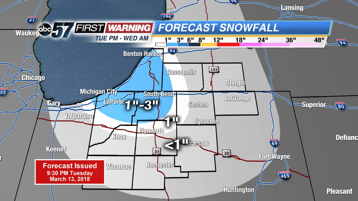
Snow squalls continue Tuesday night, ending by mid-morning Wednesday. A band of heavy lake effect snow cut across St. Joseph, Berrien and La Porte Counties, roads may be covered in the morning.
Snow ends Wednesday morning and skies clear for the afternoon. The pattern ahead has more sunshine but temperatures struggle to warm. Highs stay in the lower 40s to end the week, the weekend still looks fair, with highs in the mid to upper 40s. Next week high temperatures stay below normal.
Tonight: Lake effect snow showers, low of 22.
Wednesday: Morning snow showers, then clearing, highs near 40.
Thursday: Partly cloudy, high of 40.
Friday: Sunny, highs near 40.
Sign up for the ABC 57Newsletter