



Today will definitely a day you need to get outside and enjoy! We will start with mostly sunny skies, and have increasing clouds during the afternoon. Temperatures will be mild, in the mid 50s, and winds will be much more calm than yesterday. The next system moves in by early Sunday morning. The system will bring rain, some wintry mix and snow. The models are showing discrepancy about the track of the system, and the track will determine if we have more snow falling north of US 30 throughout Sunday. Some models suggest we could have 1-4” of snow, with the highest amounts falling in northern Berrien County, MI. We will need to wait until tonight’s models to determine exactly how much snow we could see Sunday. Either way, snow won’t last long, and will likely only accumulate on cold surfaces like grass, cars and some sidewalks.
Today: Mostly to partly sunny. Highs around 55.
Tonight: Mostly cloudy, low of 38.
Sunday: Rainy, snowy and breezy, temps around 39.
 Heavy rain is possible throughout the day on Sunday, especially in the early morning. Areas south of US 30 will see primarily rain, while areas north of US 30 will have rain mixing with snow.
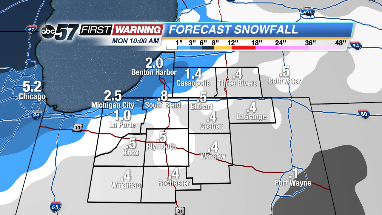 Snow accumulation is most likely on the north/northwest side of Michiana, but everyone could see some flurries Sunday night.
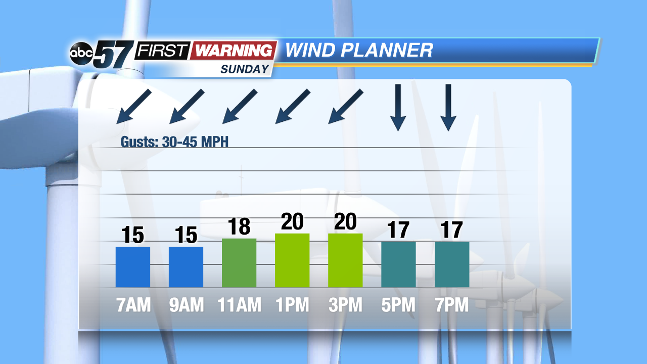 Winds will be very breezy, especially during the morning and midday.